
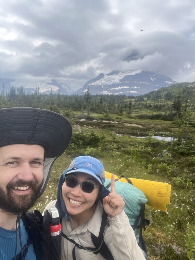
Three summers ago Bill and Viv hiked from the American Border to Jasper (sections A – E of the Great Divide Trail). Details here: https://bill.batemanzhou.com/gdt2022.html
This summer, Bill and Viv did the hardest hiking trip they’ve ever done – 300km of the hardest sections of the Great Divide Trail (sections F and G). Immediately after, they then hiked the 200km Great Divide Route, a trail-less route in the North Canadian Rockies that less than 5 groups have hiked previously. This turned out to be much harder.
The 23 days of journals are pretty long, so here is the TLDR:
- We hiked 500km from Jasper to Monkman Provincial Park. We passed no towns.
- The first 300km were sections F and G of the Great Divide Trail. Indeed, there was almost always a trail that we would miss greatly.
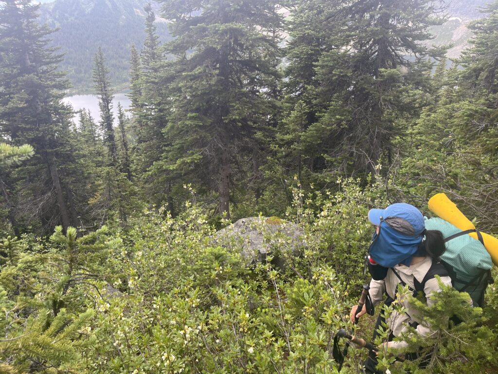
- The last 200km was an extension called the Great Divide Route that, at times, crushed our souls. There was no trail. Just us, animals and plants, and the immense Rockies.
- About mid-double-digit amount of people hike sections F and G annually. About mid-single-digit amount of people hike the Route annually. As far as we know, Bill and I are the first to continuously do both.
- It was awesome.
So much gratitude for the following people:
- Everyone who hiked and posted their trip reports prior to us – Dan Durston, Gmoser group, Meghan and Bailee, Funsized.
- Bill’s Dad, Steve Bateman, for being the best trail manager
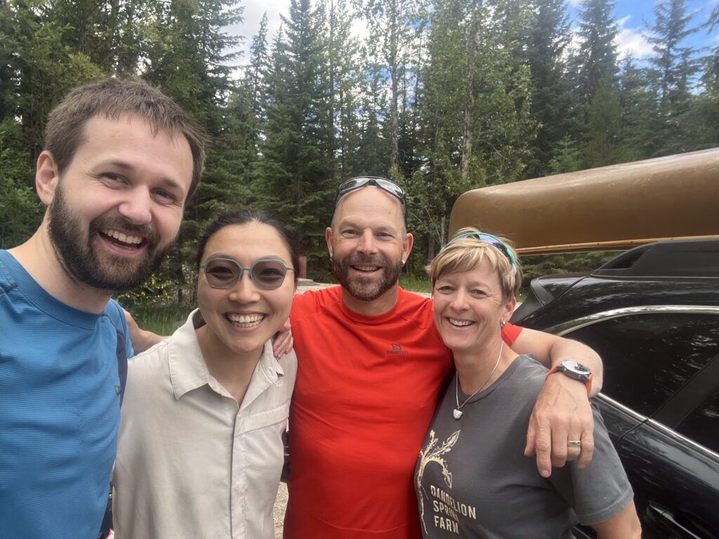
- Our friends Patrick and Marina, and their adorable baby Aaliyah, who met us at Monkman with BBQ and wine!
Day 1 – It All Begins!
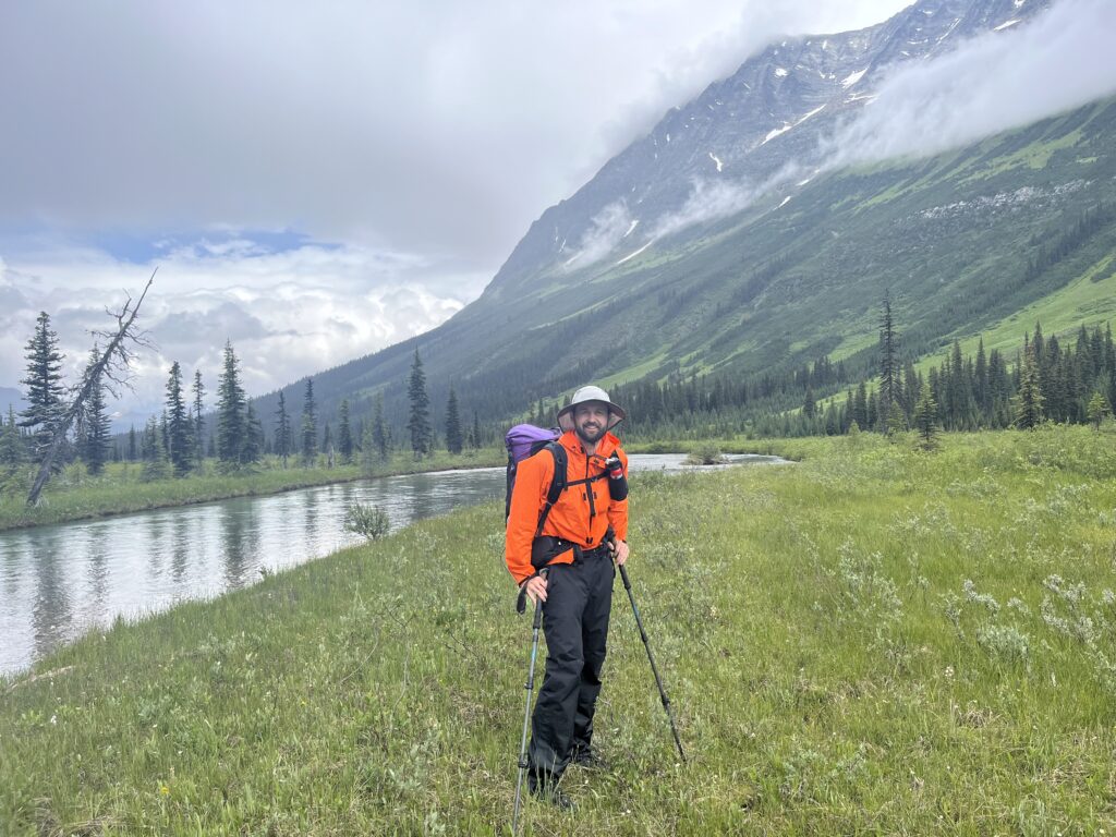
July 12 – 16km – 570m gain – McBride to Miette River Camp
Starting the trail! Dropped Rosie off at Joy and Sean’s and walked into town. Got some cheese at the grocery store for lunches and coffee and tea at the café. When there’s someone to pick up at McBride they put out a green trash can as the signal.
We got chatting with a couple who were just checking out the station on their way out of a cool canoeing trip in Nation Lakes. Just as they were leaving, we learned the train was at least an hour late. They offered us a ride! They tetrised their gear a bit to fit us and off we went! We had a nice chat on the drive over, and managed to start hiking at. The train probably would have dropped us off sometime after 5! Thanks Farley and Sheila!
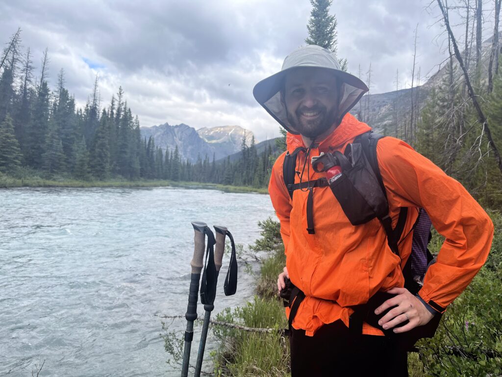
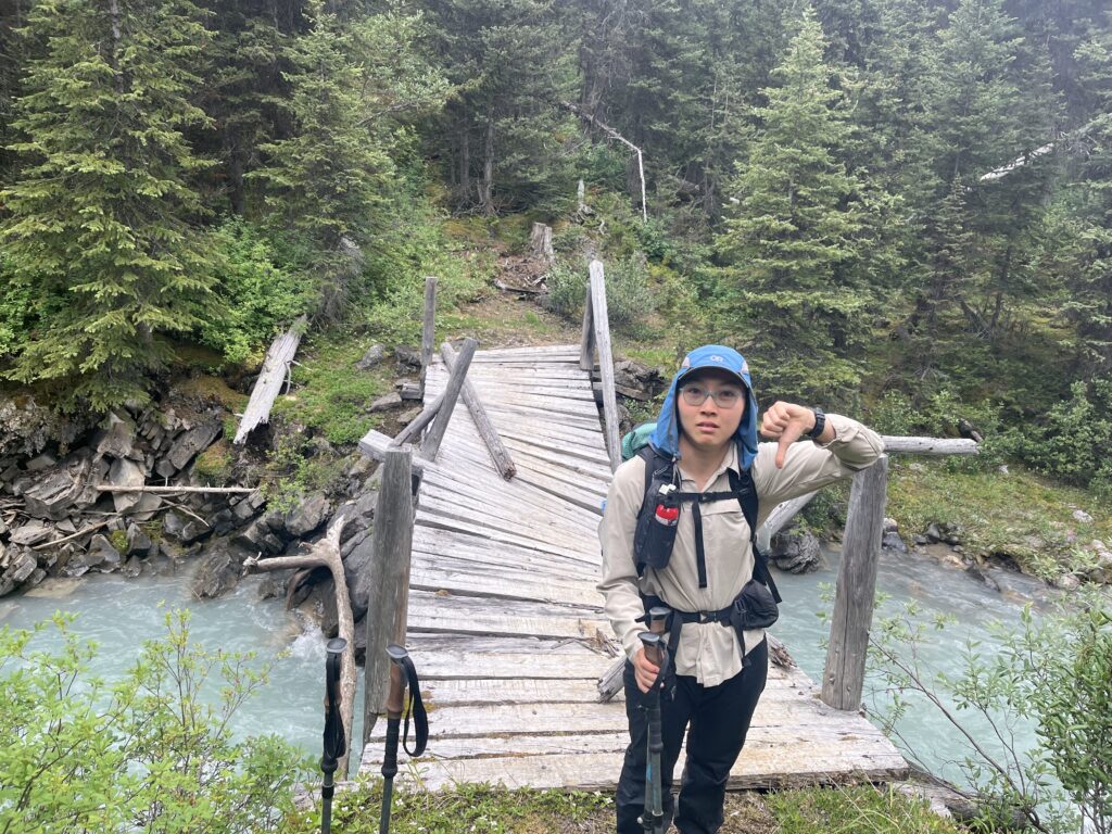
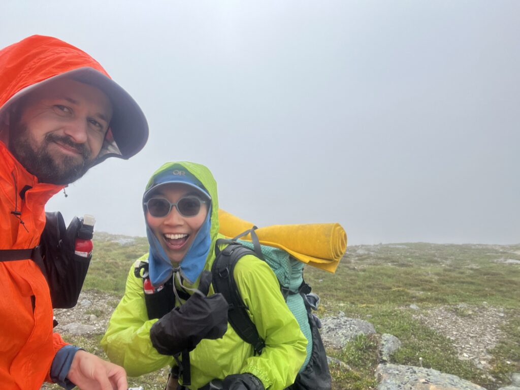
Got dropped off at the Miette River Trailhead, just inside the Jasper National Park gate. The first 4km or so was easy walking on an old road. Then the real trail started. Immediately quite overgrown, and relatively steep. The trail was easy to follow, but the overgrowth and deadfall meant we couldn’t go fast. We very quickly switched to pants. Thankfully it wasn’t particularly hot or sunny.
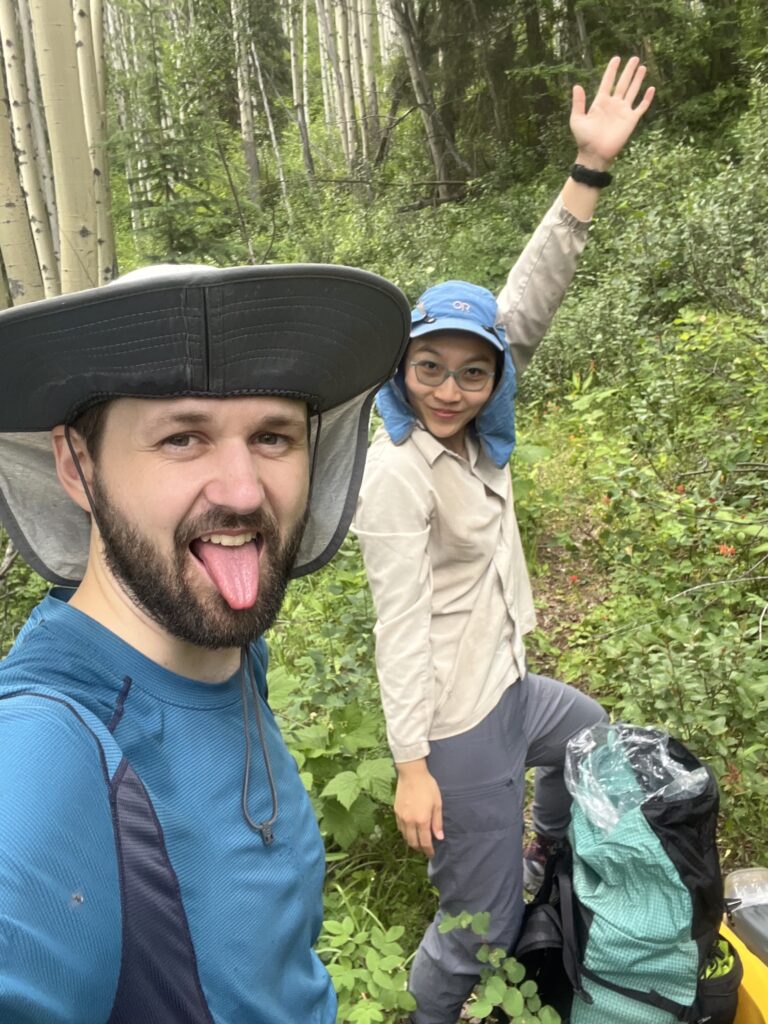
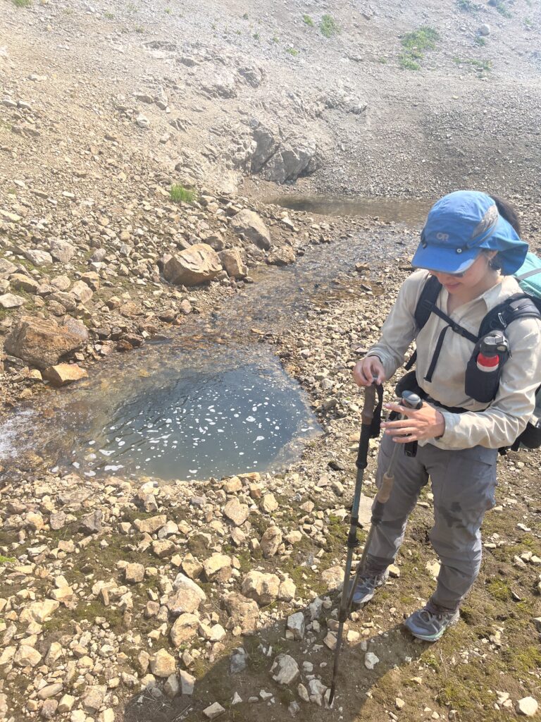
After a bit the trail mellowed out and so did the bush. Got to camp around 8ish. Immediately discovered the water reservoir bag does not perfectly seal onto the water filter, making it basically useless – nice! Set up camp and had yummy dinner, then off to bed!
Day 2 – Wet Bums All Day!
July 13- 27km, 1379m ascent – Miette River to Colonel Pass
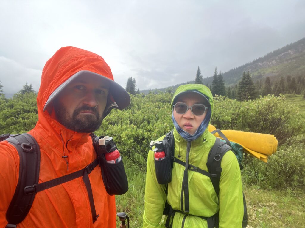
Wet bums all day! For reals! We were absolutely drenched but decently warm when moving. Medium high clouds allowed us to play hike and seek with a number of peaks all day! Spotted two beautiful glaciers.
If you count a river forge as both feet getting drenched, there were definitely over 10 today. No drama though.

The two passes lead us into BC and back out again. Can confirm BC mosquitoes are not more chill. The sights were beautiful though, with clouds sweeping by.
We ran into two hikers doing the GDT SOBO! We shared some commiserations on the weather, though hopefully out next 10 days will be better than their previous 10 since it “rained to some extent every day.”
Vivian dreamed of gold bond in her socks for many hours, and was trying really hard to brew a poo to no success.
To both our delights, there was a massive beautiful sitka spruce at the campsite which kept the ground beneath it dry all day! Made for a great dinner spot. We put some of the korean BBQ jerky in the Pho dinner which made it bomb.com. But unfortunately the grease from the pork fat was impossible to fully washed away, until grease-flavoured oatmeal tomorrow morning I anticipate.
Day 3
July 14 – 24km – 410m gain – Colonel Pass to Steppe Creek
Writing this a day late. Crossing the divide was an easy jaunt, and then we had a long descent through a burn patch. Thankfully someone had cleared the deadfall a couple years ago, but new deadfall and slippery rocks meant we didn’t go too fast.
On and off rain all day. Not too bad but couldn’t really dry anything.
We turned up the Moose River – thankfully didn’t have to ford it at its widest. We also didn’t have to ford Upright Creek since there was a handy logjam complete with rope handrail. We did ford the Moose maybe 4 times (although the map only labeled 2). Lots of marshy meadows and searching for the old horse trail.
We got into camp and were all settled in for bed when another couple walked in! We didn’t talk much since it was late.
Cold night tonight – should get down to 3 C!
Day 4 – Moose Pass Is Majestical
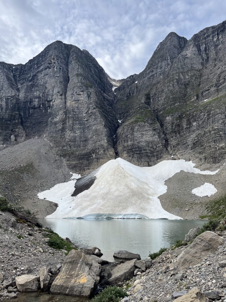
July 15 – 32km – 900m ascent – Steppe Creek to Adolphus
Today was an unreal treat.
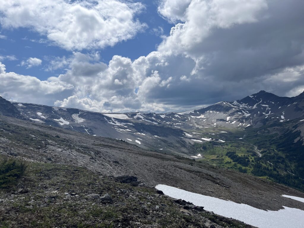
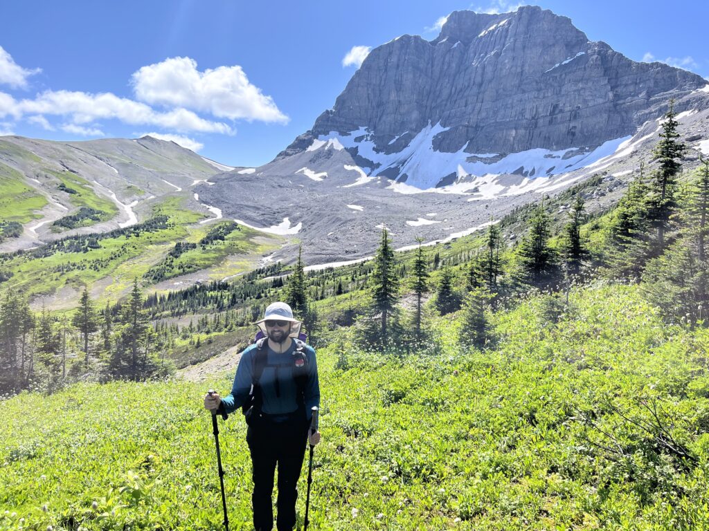
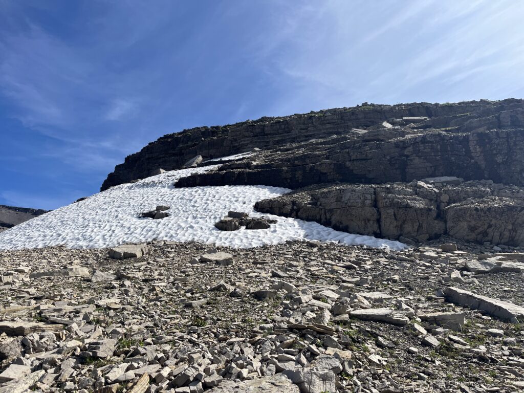
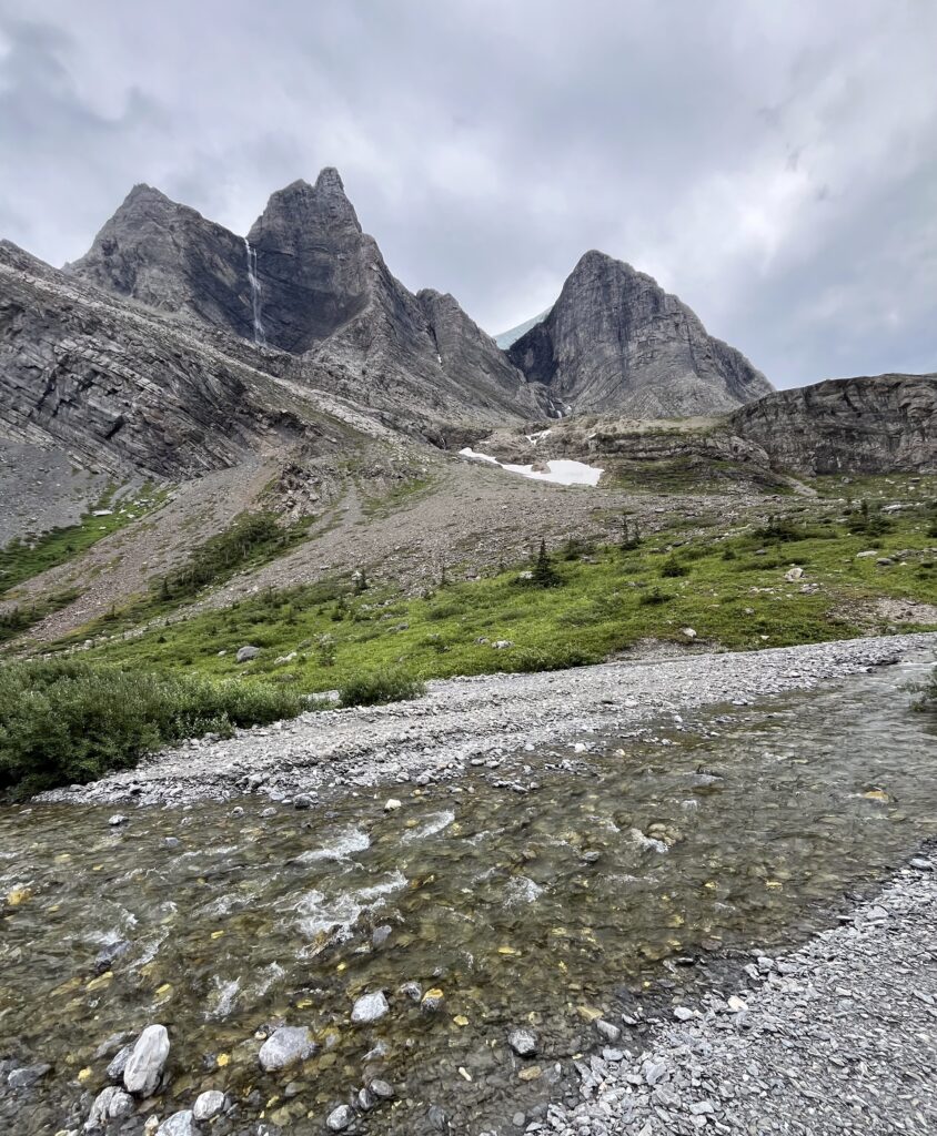
Hiked up a gradual incline to Moose Pass following the Moose River. It was really neat to see the river dwindle as we gained elevation. The mountains west of the pass was so beautiful, like a brushstroke of various shades of brown and red was swiped across the horizon. The textures were the epitome of the sedimentary rockies. Made for an amazing lunch break.
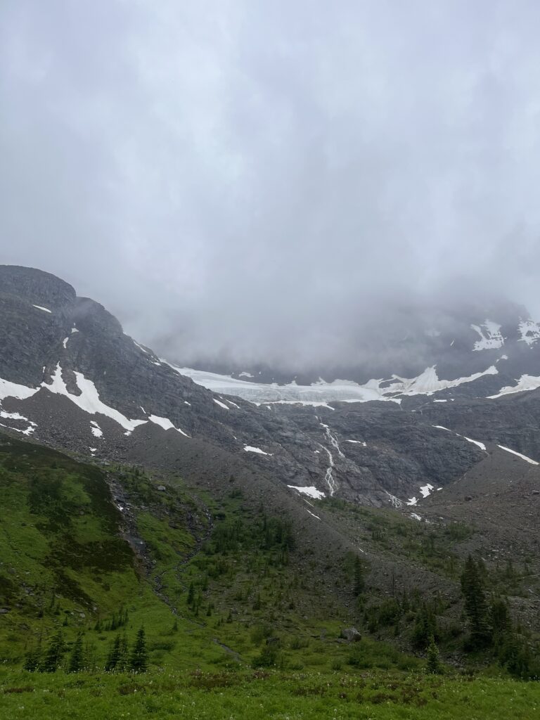
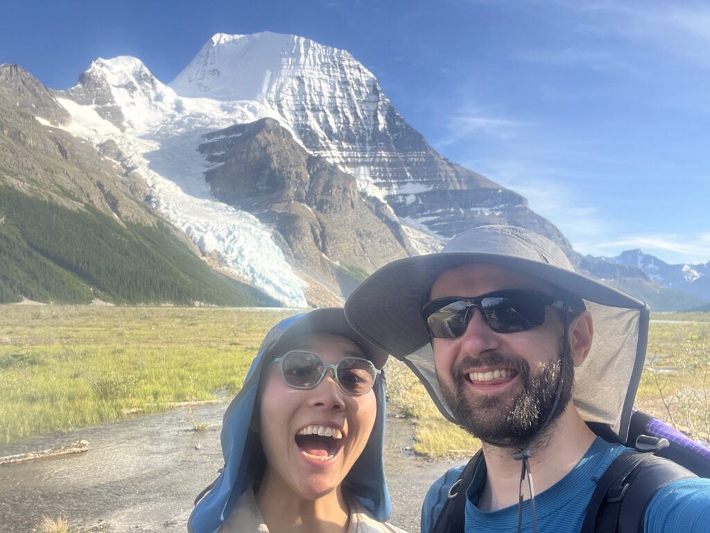
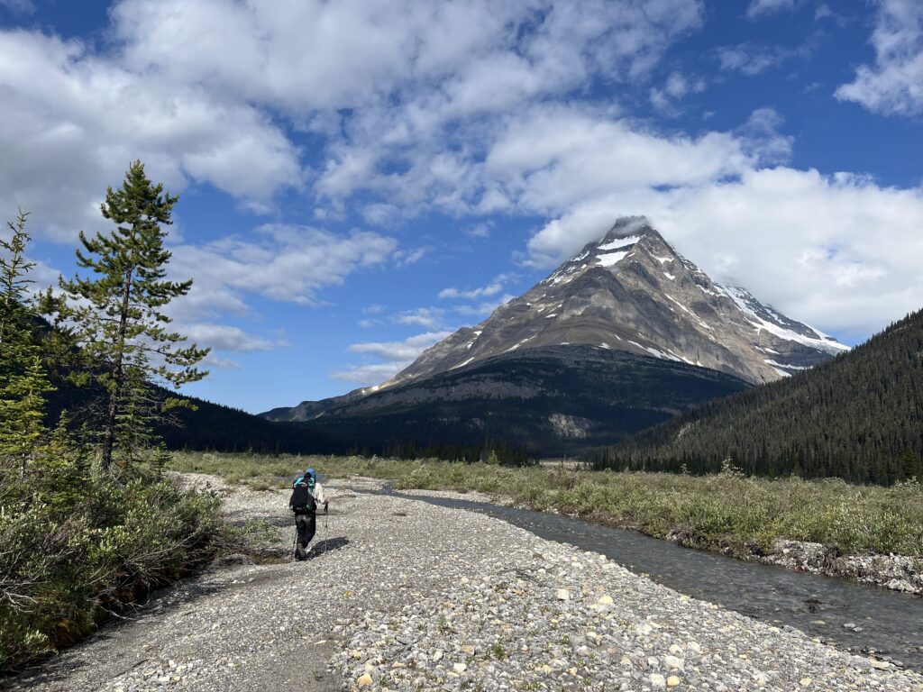
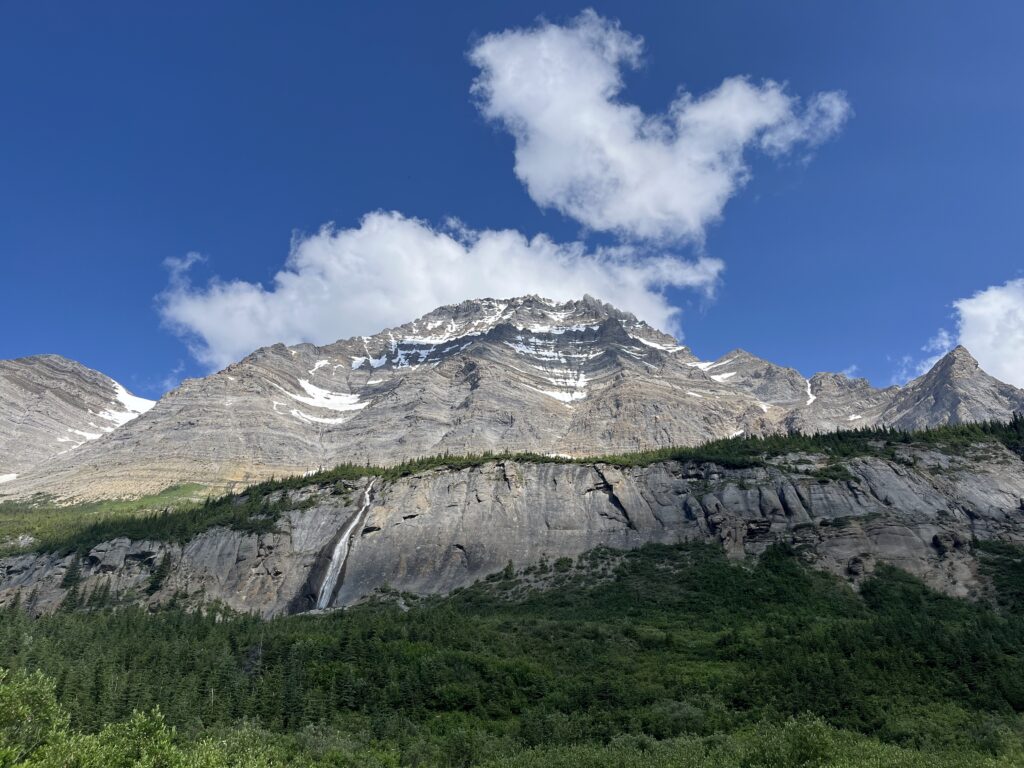
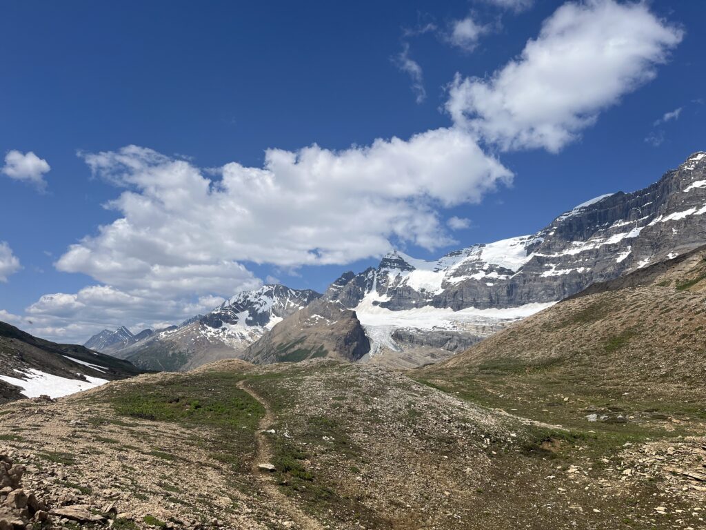
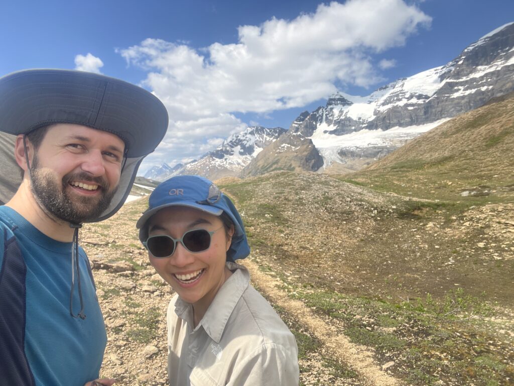
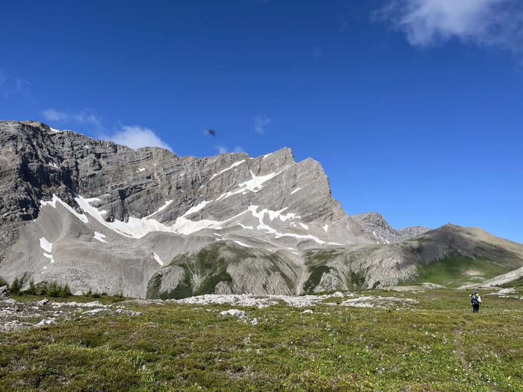
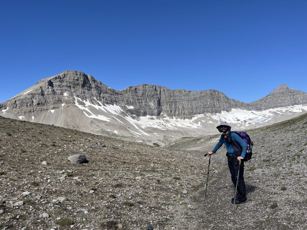
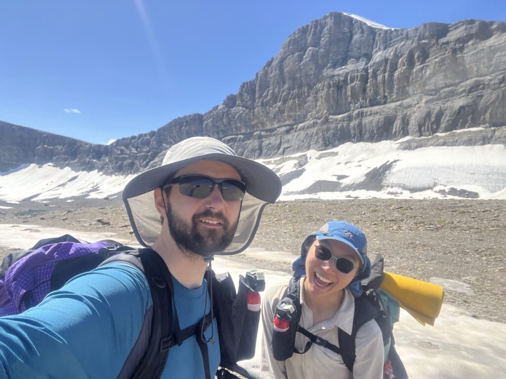
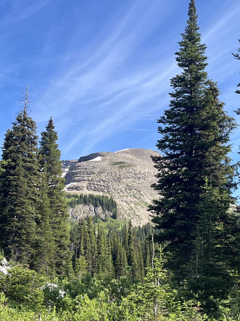
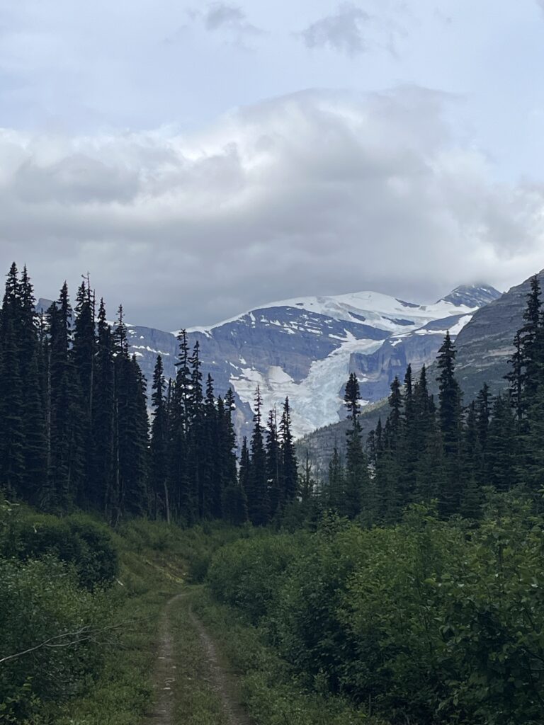
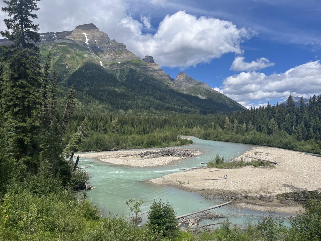
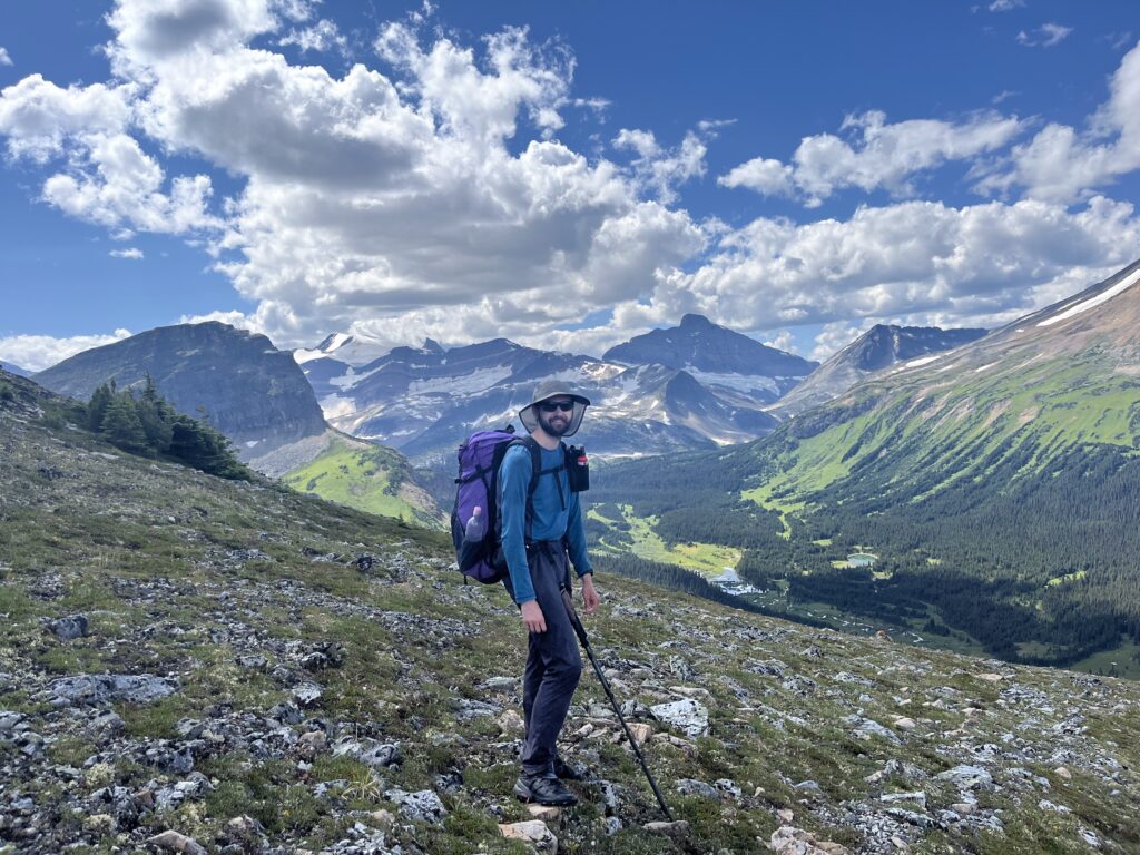
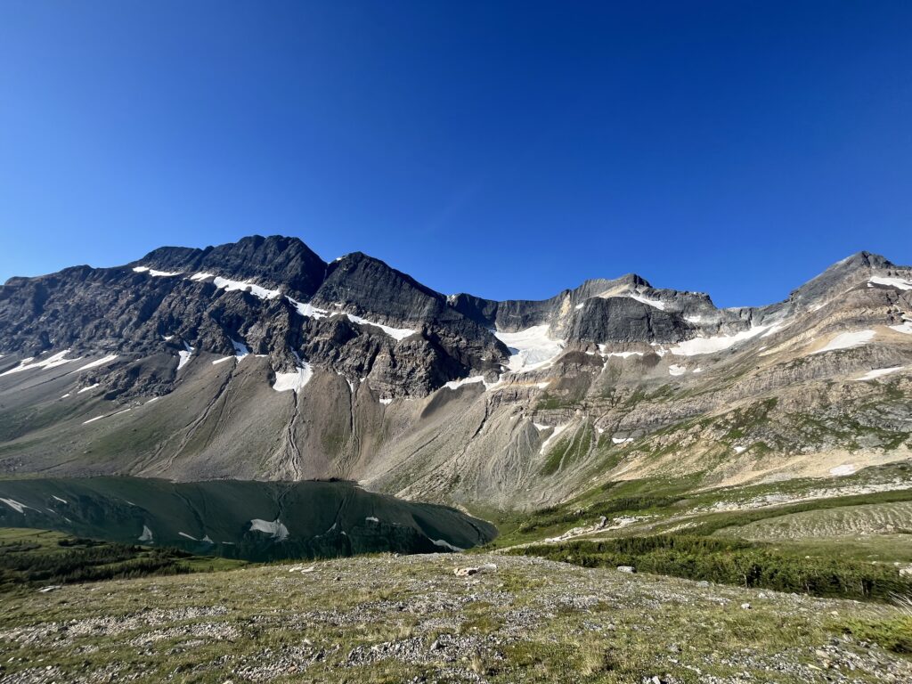
Although we got to camp at around 5:30, we decided to hike about another 4 km (and back) to check out Berg Lake and Mount Robson – highest peak in BC (pic below)! The intense glacier that extended from the corniced peak to the lake was soooo jagged, full of personality.
Saw a wee teenage grizzly which broke our hopeful target of 0 bear sightings, but no drama.
We ran into the couple from last nights camped, and Viv asked why they got in so late because she thought they might have had a huuuge day from the Moose access. Turns out one of them accidentally sprayed themselves with bear-spray. She said she doesn’t recommend it.
It looks like we’re going to get at least some rain everyday for a long while, so I’m glad we were spoiled with today.
Viv’s shoes toebox is way to small, leading to v bad blisters. Time to begin the nightly blister draining ritual!
Day 5 – Multiple Shoe Surgeries Day
July 16 – 25km – 320 gain – Adolphus to Chown Creek
No rain today! Forecast was for thunderstorm, and we did hear some thunder, but the storm missed us entirely. Quite happy about that.
A bit later start today. Viv tried some insole surgery to hopefully help with blisters. Painful hiking today.
Mostly hiking along the Smoky River today, on the North Boundary Trail. The floodplain was very cool. Trail was mostly ok, lost it a couple times in marshy meadows, and once in a slide path, but generally decent pace.
Unfortunately the insole surgery did not help, so Viv had to return it to it’s original state. She then tried Surgery #2 where she ripped bits of the stiff upper to release tension on her toes. This seemed to help!
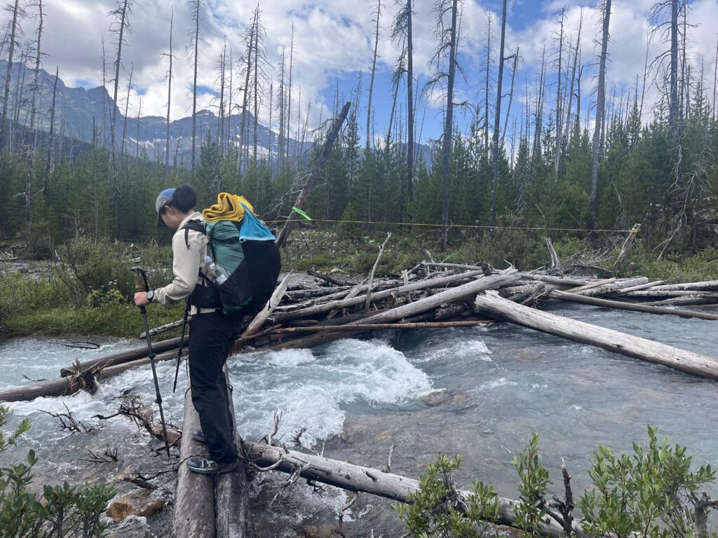
Couple creek crossings. First had a broken but usable bridge. It looked very sketchy, but still sent. Carcajou was fast and slippery, definitely felt the scariest. Crossing Chown Creek to get into camp was pretty easy since it braids a lot just downstream of the trail.
Saw a river otter on trail! He looked quite funny when running – slower than marmots! We also saw a porcupine in camp. He was not scared at all of us, and slowly ambled away. We saw him again a bit later, so built a fortress of driftwood around our tent. Hopefully he doesn’t wake us up tonight, but there are lots of comments on FarOut about nosy porcupines around here.
The camp itself is beautiful, right on the Chown Creek. Might get damp overnight but it’s so cool to be right next to the floodplain. We saw a porcupine so we decided to barricade our tent so he doesn’t chew our stuff.
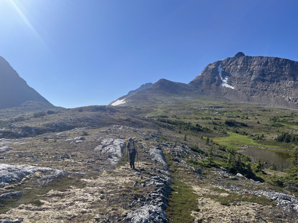
Day 6 – Bijjilion Marmots and Glaciers
July 17 – 28km – 1515m ascent
Today was incredible!
Began with a traverse along the Chown floodplain. Easy walking and freezing toes. No drama with the fords.
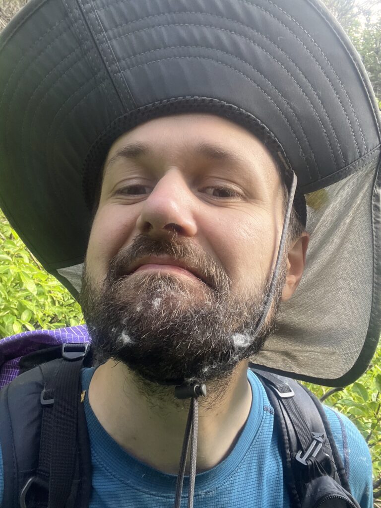
Then, a big ascent and alpine walk! Luckily the alder bashing was only really bad for maybe 20 minutes (feet swallowing mud with alder groves taller than us) and moderately bad until we reached the alpine. There was so much pollen fluff that it covered bill’s beard!
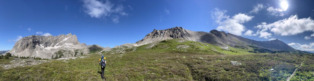
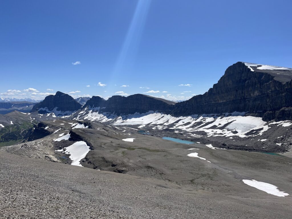
Alpine walking is one of my favourite things in the world. Soul filling views in all directions – ragged peaks of all shapes, glaciers and crevasses for miles, waterfalls with different personalities. Endless in all directions. These are the views that stay with me.
The hoary marmots kept us company. We met Usain Bolt, the fast marmot, and Rob, Mt Robson’s marmot father (or so he says).
Today was just superb.
Day 7 – Soaking Resupply
July 17 – 15km – 1330 m gain
Resupply day! New plan is to camp again at Blueberry Lake, and just do the ~15km round trip to the resupply lockers and back. Forecast was for lots of rain, so we didn’t sleep in too long.
The way down was pretty chill, steep in parts, muddy in parts, basically just a creek in parts. Made good time down, but it started raining maybe 2/3s in. The rain wasn’t too bad on its own, but the trail had lots of brush, so we quickly got soaked.
At the resupply, we hid under a big spruce and arranged the food in our ursacks. We also left some treats! Coconut water and canned mangoes and peaches.
The 1000m accent back up was cold, wet, and a bit miserable. Luckily it wasn’t too long, and took around 3 hours back up. We dove into the tent and got dry and cozy while it kept raining.
Leaving the tent to filter water and have dinner was a test of resolve. There was a nice break in the rain, but we still had to put on some wets and brave the bugs. Eventually the sun came out which was a treat! Early bed tonight and back at it tomorrow!
Day 8 – Mud Massage for Five Hours
July 18 – 350 m gain – Blueberry to Jackpine Camp
The first pass back into Alberta was lovely, with nearby peaks hidden in mist. The descent into the valley was also enjoyable and we played many games.
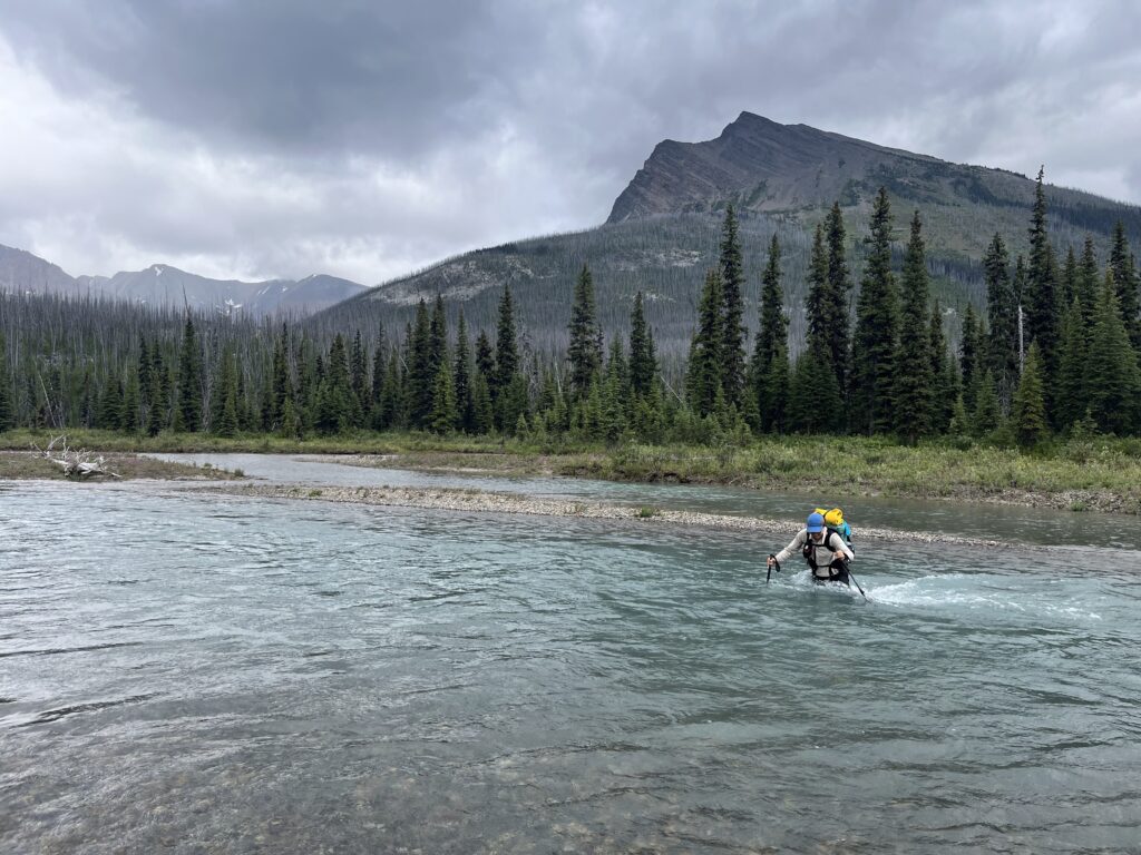
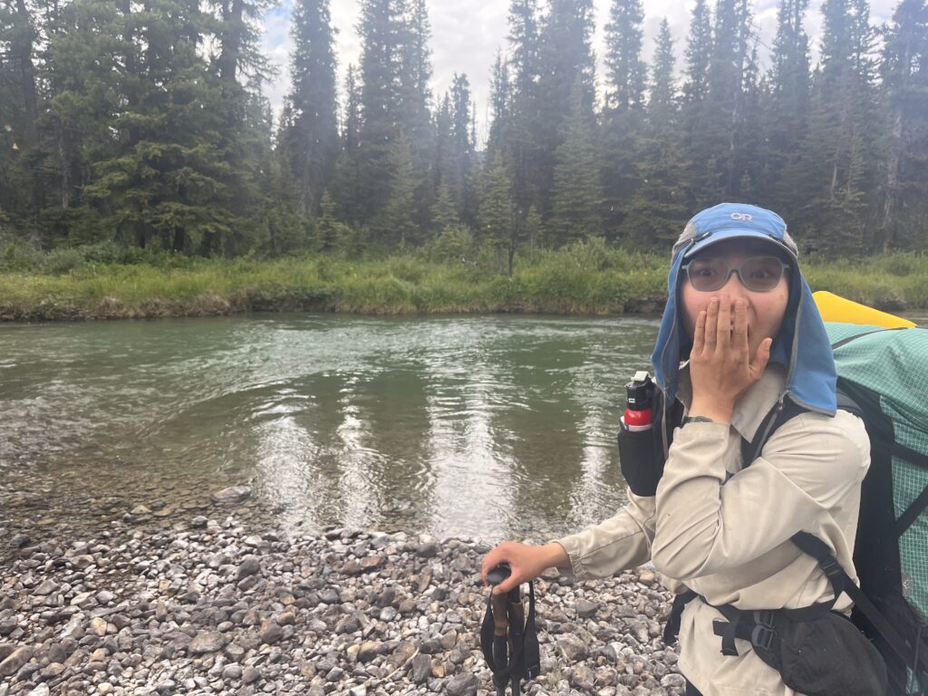
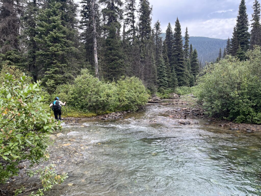
The majority of the day was walking along the Jackpine River which we forged about twenty times – no joke! Luckily it was relatively slow moving so when Viv went guns ablazing on a crossing thinking it wasn’t too deep, she didn’t get swept away when her backpack started floating away from her body. The depth of glacial water can be deceptive.
Now for the highlight of the day – MUD!! Brown mud, black mud, red mud, stinky mud. We got it all. We felt mud between our toes for hours. Ankle to calf deep mud. Viv also had a nice rolling fall in a deceptively deep mud section and lost one of her water bottles , likely to the river. To make things more memorable, the mosquitoes were so bad Bill put on his rain mitts. Our feet are maximally exfoliated.
Day 9 – Big Elevation Day
July 20 – 29km – 1640 m gain – Jackpine Camp to Morkill Pass Camp
As soon as we left camp we were back in mud. Pretty soon we passed some old trapper cabin ruins, and a better spot to camp. Oh well.
The hike up to Little Shale Hill was occasionally muddy and quite a big ascent. Then we lost all that elevation, crossed a river (not the Jackpine! a new river!), and gained it all back plus more. Getting up Big Shale Hill was a mission. It was past 2pm by the time we were on top, and only about halfway in distance!
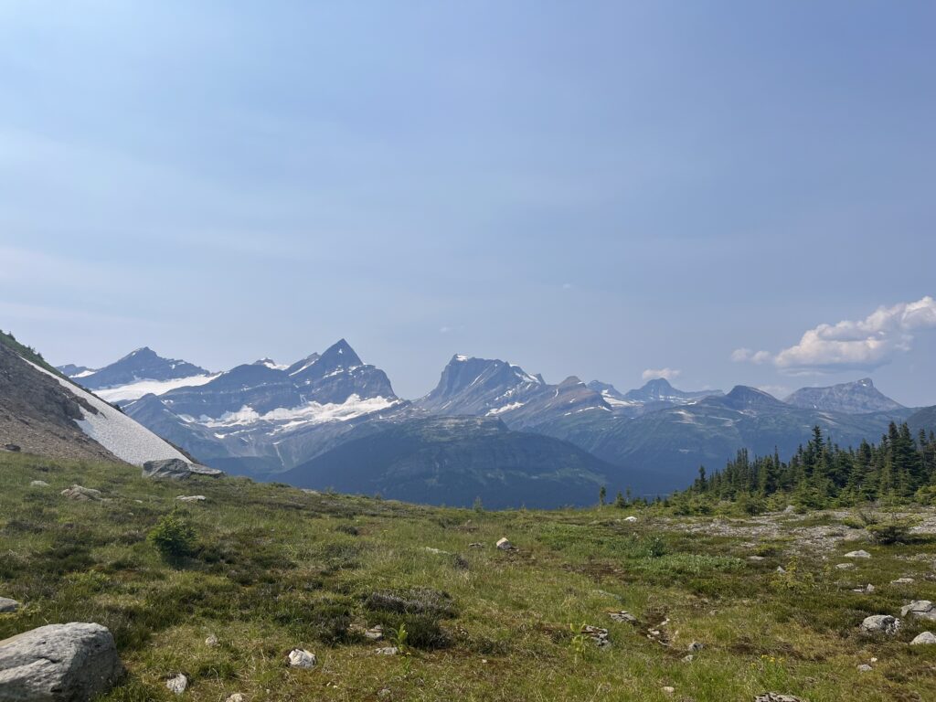
The views at the top were incredible. We could see the Jackpine River far behind, and on to today’s new mountains (Morkill, Talbot) and tomorrow’s (Fetherstonaugh). We also saw lots of marmots!
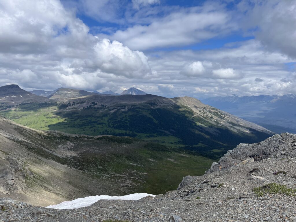
The hiking after that was mostly cruisy. Amazing alpine walking along the ridge of Big Shale Hill, and some really well looked after trail through the forest. Go GDTA! Still had some boggy sections though.
The last 5km or so were very tough, definitely feeling the elevation.
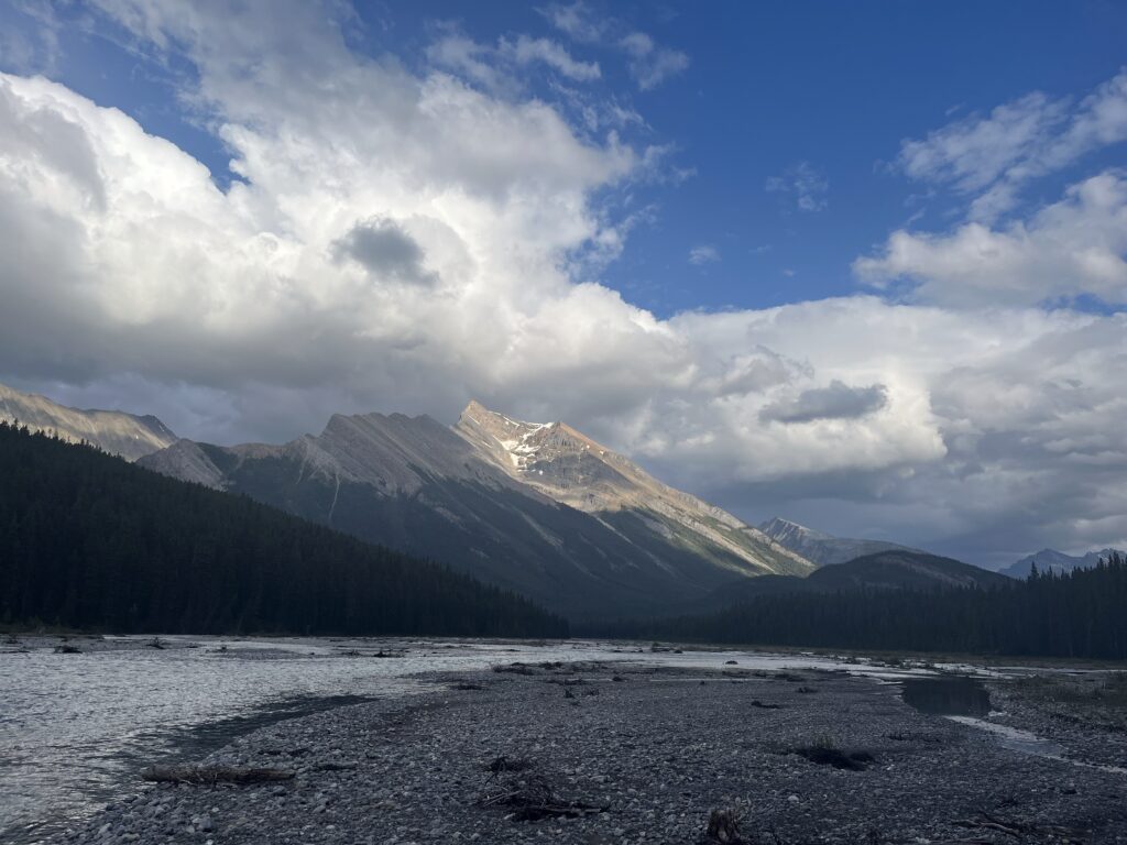
We also noticed some haze – according to trail manager Dad there is a fire some 150kms to the North (near Dawson Creek). The wind was in the right direction so we think it could be from that. It’s 58% under control and quite far so hopefully it doesn’t become a problem.
Day 10 – Freezing and Raining But Not Freezing Rain!
July 21 – 28 km – 1060 m gain – Morkill to Copper Kettle Camp
The thing with thru hiking is there is always something to be grateful for.
Most of today was raining. It was also our coldest day yet. When the trail went through bog, every step was soaking. When we went through willow groves, giant waterdrops fell off the branches onto us, utterly drenching us more. The groves were often taller than Viv.
But, I thought to myself. At least it wasn’t freezing rain! At least I wasn’t shivering! At least no fires!
Luckily besides the bog and willow portions in the muskeggy parts, the trail was fabulous. We averaged 3km per hour including small breaks and got into camp at decent time!
Day 11 – Beautiful Sun and Beautiful Cabin
July 22 – 33 km – 1280 m gain – Copper Kettle to Kakwa Lake Cabin
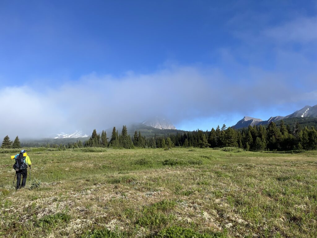
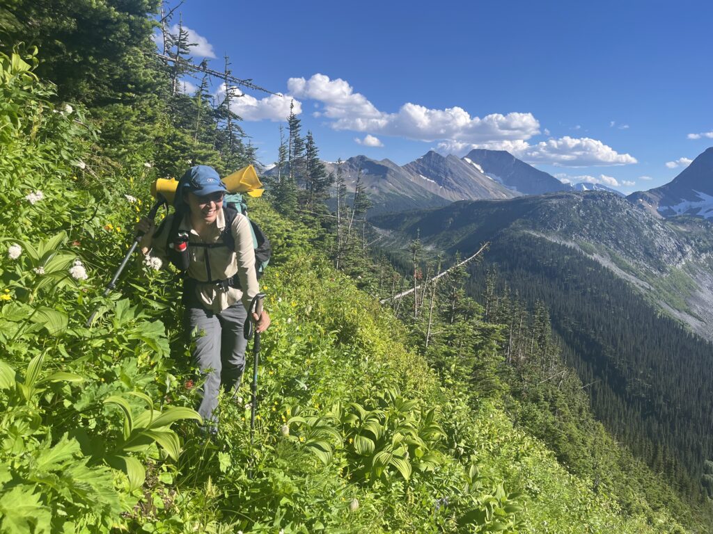
Started early with a cold breakfast. Hard to get going. The meadows were wet and misty, and somehow we ended up on the wrong horse trail. Bushwhacked back to the GDT and got some good pace going up to Surprise Pass.
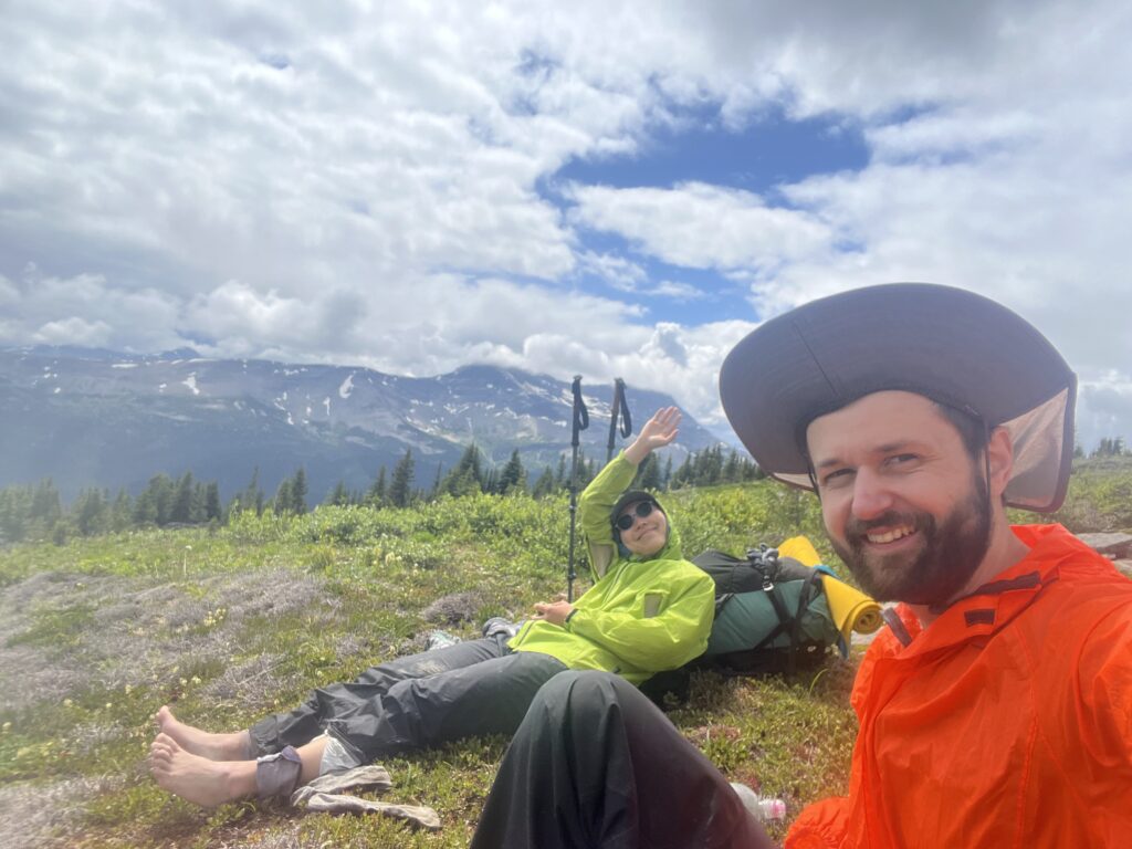
Amazing weather today actually let us see the mountains all around. We took the Surprise Pass Alternate, which was a slog and quite hot but very beautiful. Wallbridge Mountain gave similar vibes as the Rockwall.
Lots of elevation gain to basically summit Mt Wapiti. Then a long and difficult descent through a bunch of cliff bands. Sometimes the gps track went right through a snow patch, which made things a bit tricky. By far the hardest downhill hiking we’ve ever done.
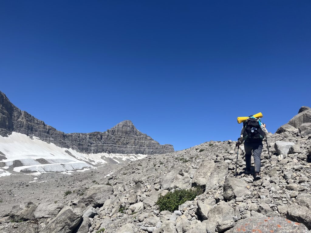
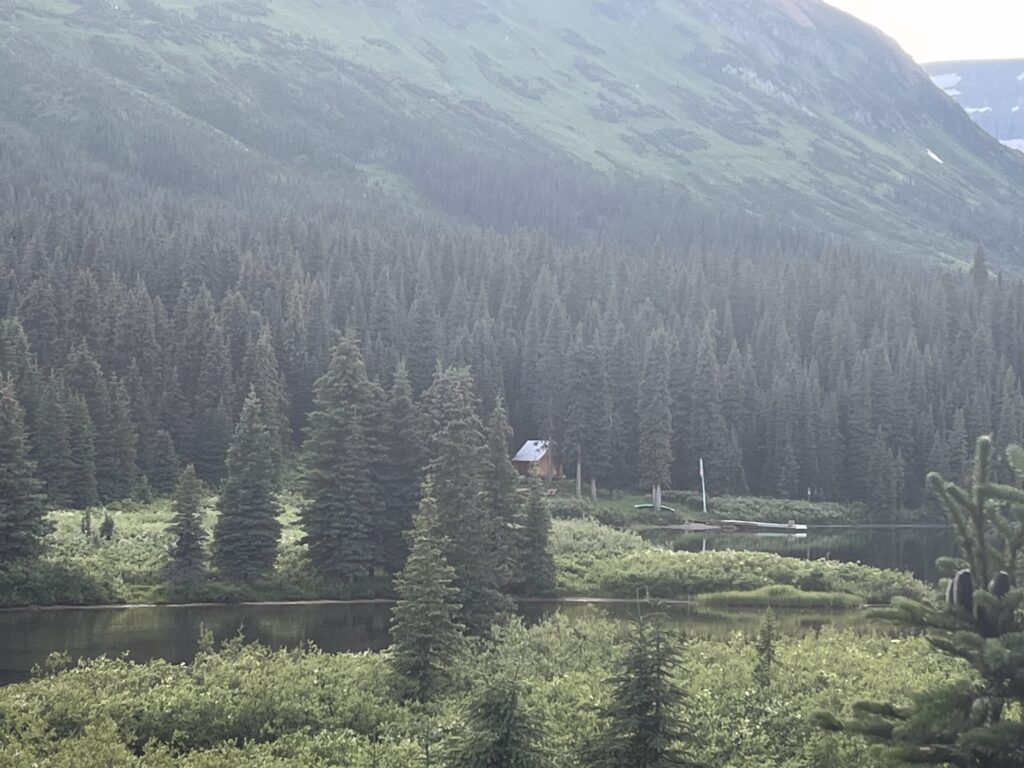
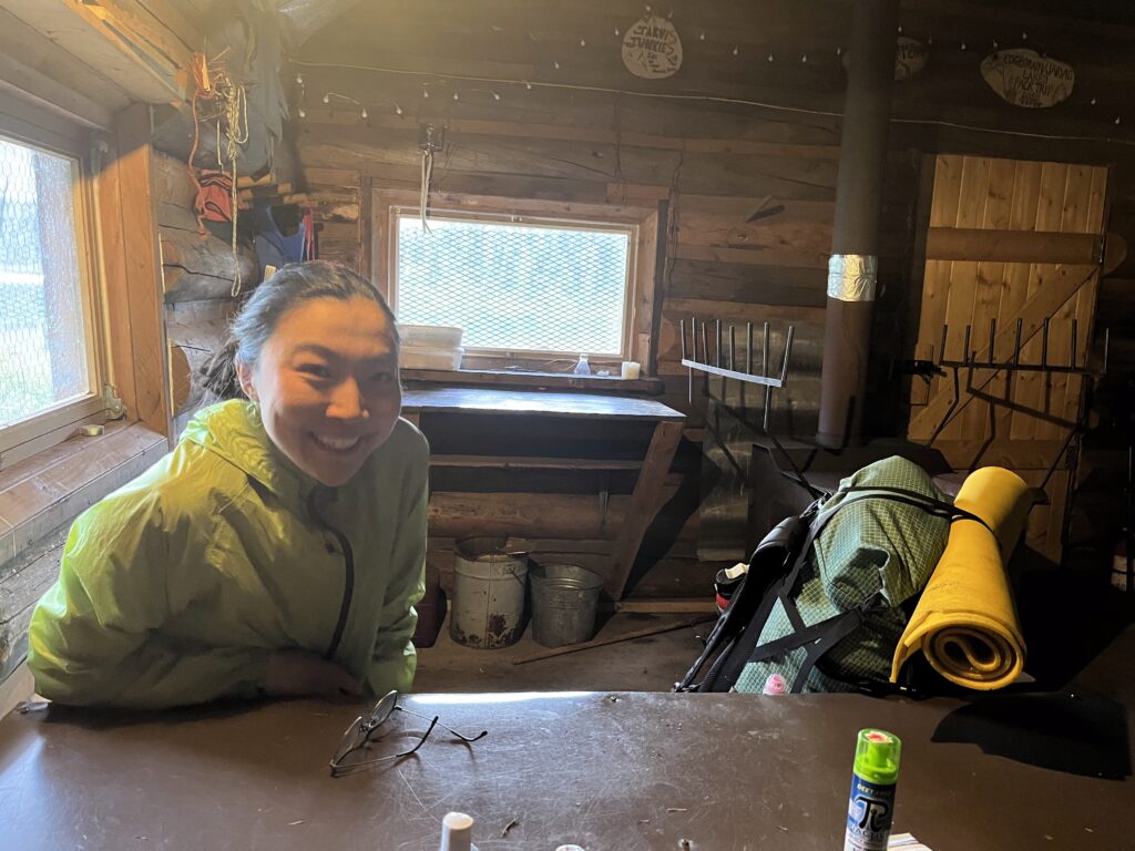
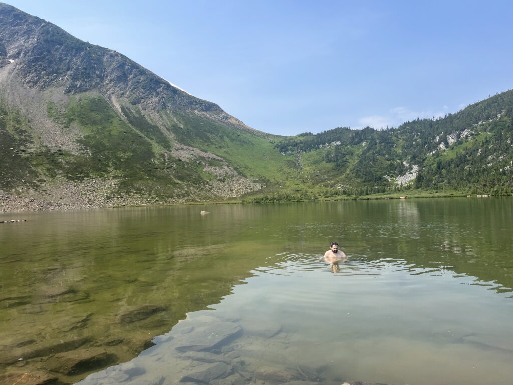
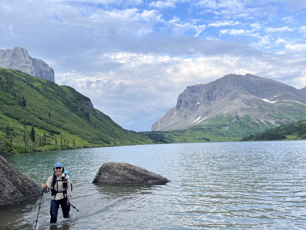
Finally got back to the GDT around 4:30pm, roughly 10kms out from the cabin. But we weren’t going to stop! Lots of meadow hopping and creek crossing and we made it! We met Steve and Dianna (the current volunteer hosts) and they got us all settled in. We had a quick dip in the lake (freezing) and then got super cozy with the wood stove. Amazing to be able to dry everything off!
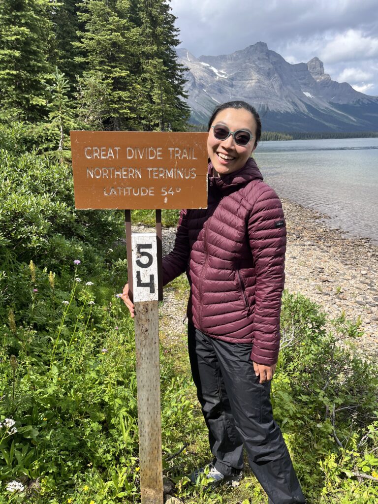
That’s the end of the GDT! Now we just have the GDR left :O
Day 12 – Spa Day!
July 23 – 0km – 0m gain (freaking amazing!)
Today was absolutely glorious. Slept in and had a nice breakfast before Viv took a nap.
Dianna and Steve welcomed us into their cabin where they shared some stories and amazing FRESH FRUIT. It was soul filling.
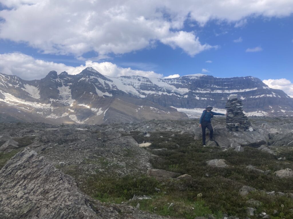
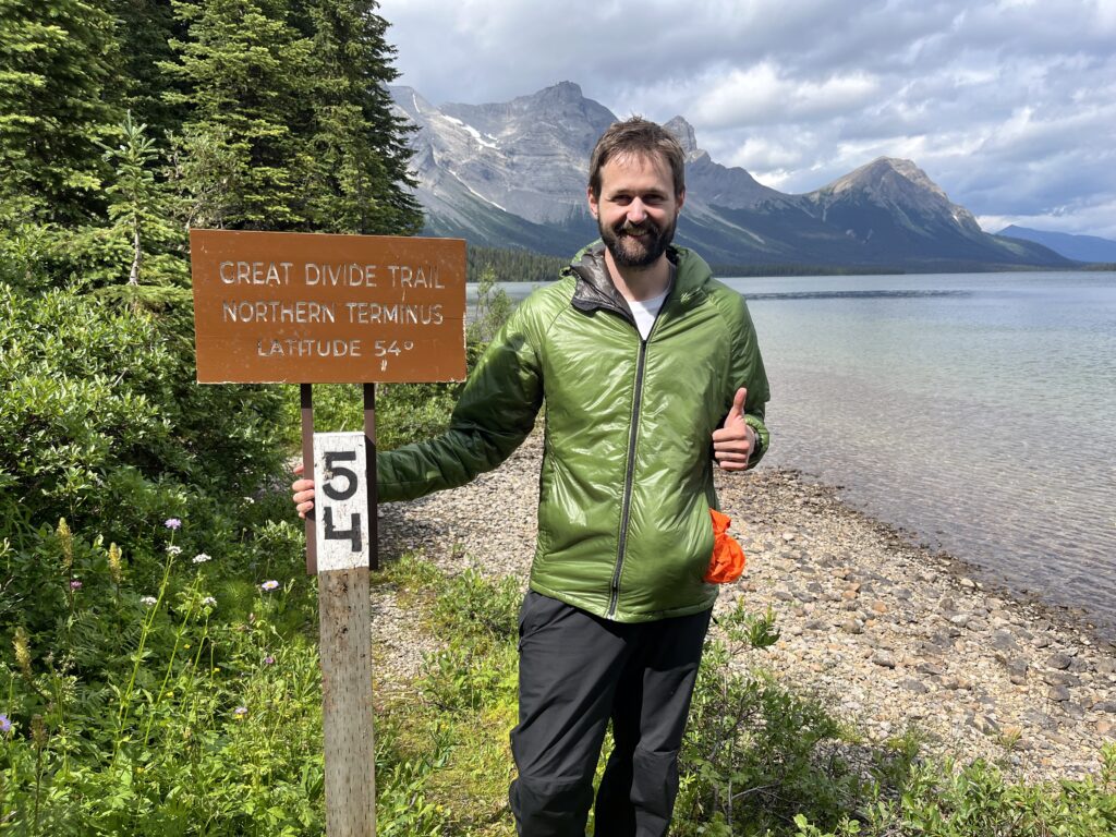
And then we went and touched the official monument that marks the northern terminus of the GDT!
We got some cabin buddies who hiked in from Alberta. While watching them fish, we got various classic zero-day things done like reviewing our plan for the next section (nerve wracking!), cutting our nails (spa!) and laundry (“laundry”).
Dianna boiled two large buckets of water for us and allowed us to use their shower house. This was by far the best shower Viv has ever had. Life affirming.
The lake views are incredible – gorgeous and enormous slabs of the Rocky Mountains. We were truly blessed to have a zero here.
Dianna and Steve further extended their generosity by inviting us to join them for dinner. We were fed freshly caught trout, home made bread, and coconut scalloped potatoes. Everything was so incredibly tasty.
It was so, so nice to not move.
Day 13 – Date Night at the Bastille Resupply
July 24 – 28km – 350m gain – Kakwa Lake to Bastille Trailhead
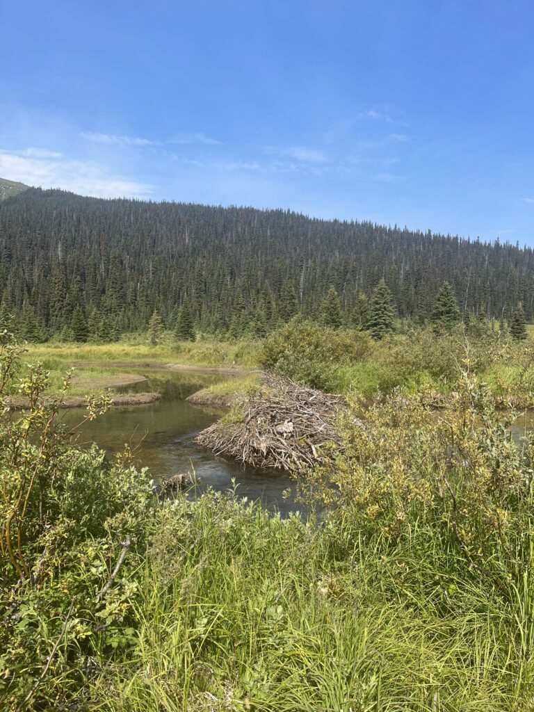
Got up early and headed out for our 28km walk to our resupply at the Bastille Trailhead. The first part flew by, really good trail until Buchanan Creek. Then we had to get our feet wet – and there the ATV tracks began. Lots of mud, so slightly slower going. We also saw what looked like a small beaver dam in the road, so there was a small pond instead of a road. Darn beavers!
We also passed a snowmobile cabin, which looked luxurious.
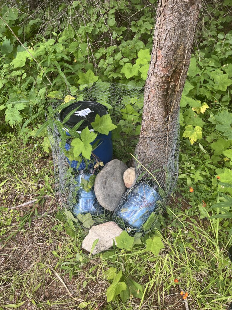
We got to our resupply around 3pm (quick day!) and got to work sorting food and other supplies. We have some special dinner tonight (noodles and soup) and nice breakfast for tomorrow (more soup) plus some treats (juice!) before it’s back to our regularly scheduled camping food. Date night!
Day 14 – Resupply Hike Back to Trail
July 25 – 28km – 790m gain – Bastille Trailhead to Kakwa Lake
Our bags each got about 10 kilos heavier with all the food, so this made the hike back much harder. Luckily the forecasted rain never came!
This is the heaviest pack either of us have carried – 10 days! Some hikers we’ve met carry less food so their pack is lighter, but we’re not about that. Viv likes to eat the moment she is peckish, and Bill likes his daily dose of 6 servings of chocolate.
One more lovely night at the cabin. The forecast for the next six days includes three days of thunderstorms and the other three days are rain. Really hope they messed something up here.
Day 15 – Cabin Hopping in Hail!
July 26 – 23km – 510 m gain – Kakwa Lake to Jarvis Lakes
The Peace River boys got up early, around 5am, for their big 37km day out. Unfortunately they do not know how to be quiet. Oh well, an early start isn’t that bad for us either, since forecast was for storms later in the day
We got going before 8am. It was quite a nice morning, but we could see some scary dark clouds. Some loud thunder in the distance seemed to get quieter, so we hoped the storm was missing us.
The trail was more or less fine until we left the tote road and took the Jarvis Lakes Route. Immediately it became muddier and brushier.
Around noon it started hailing – the storm caught up with us! It was easy to ignore at first, but quickly became a hailstorm. We hid under the boughs of a big tree and had our lunch. Eventually the hail turned into rain, and we kept hiking. It got somewhat cold, but we knew we had a cabin coming so kept going.
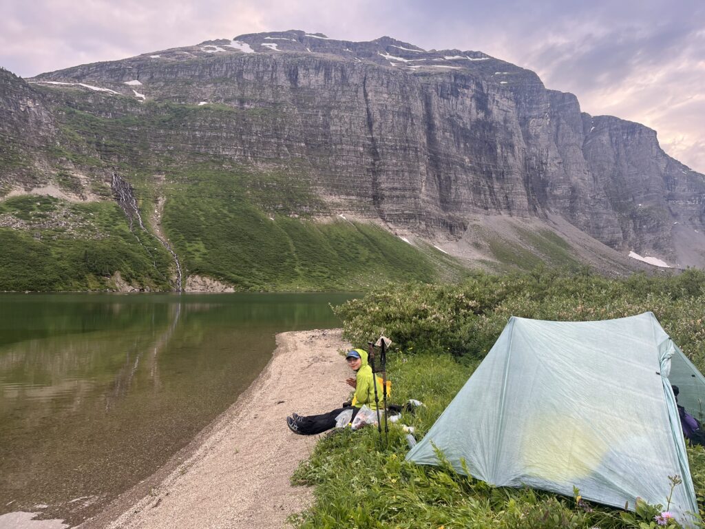
The cabin is definitely not as nice as the one at Kakwa Lake, but still has solar polar lights and, the most important, a wood stove with lots of dry wood. We got a fire going, got nice and toasty, and had a quick dip in the lake.
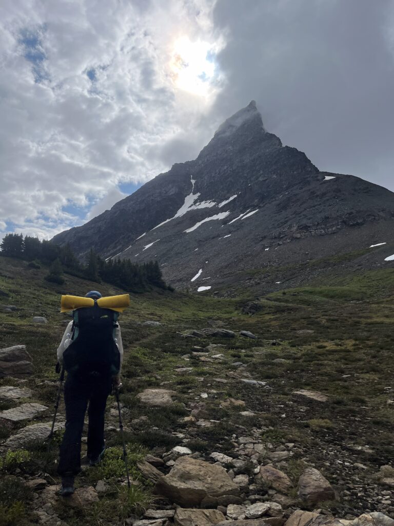
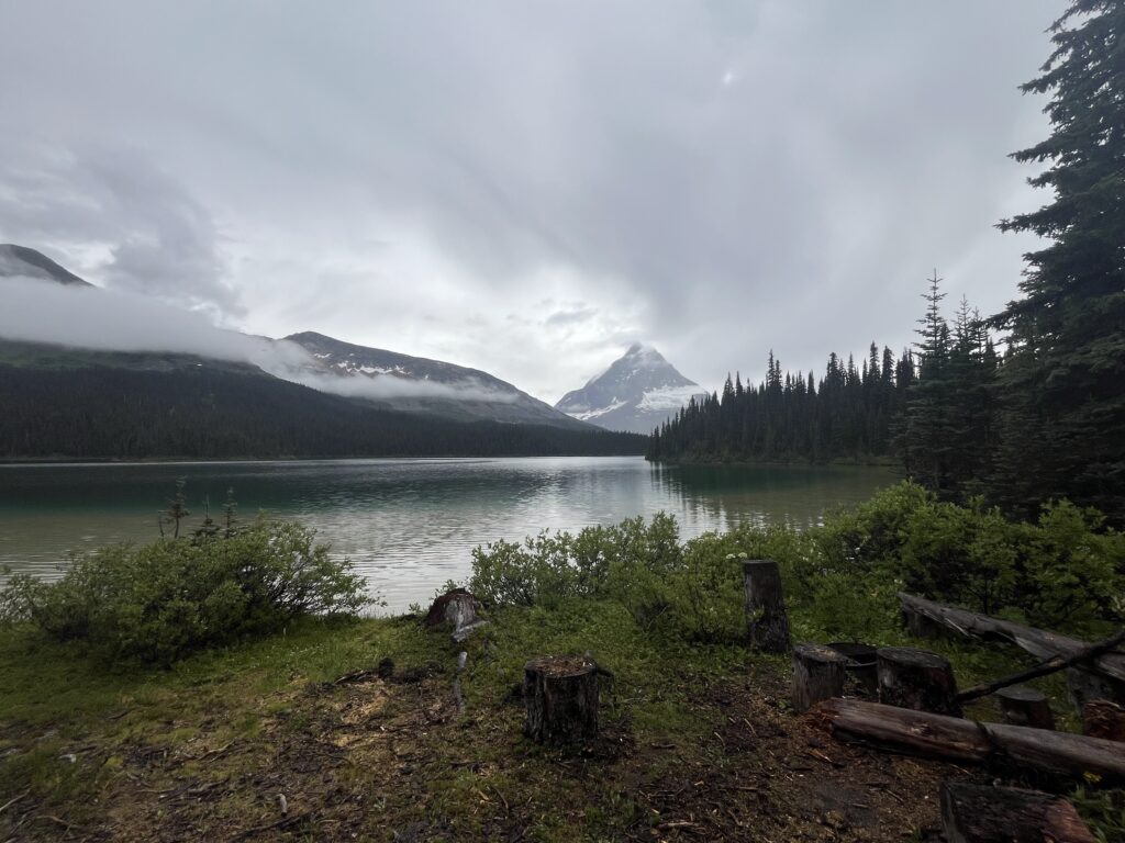
As the clouds cleared a bit, we saw Mount Ida – absolutely spectacular views from the cabin.
Garmin weather reported thunderstorms for 5 of the next 6 days, and rain for all 6. That really diminished our spirits, but the weather forecast from Daddy Bateman was much more positive – chance of rain tomorrow but likely clear for a few days after that! Hopefully it’s not constant thunderstorms, that could be bad for us.
Feeling a bit nervous for tomorrow – the true start of the Great Divide Route. In one week from tomorrow, we should be at Kinuseo Falls in Monkman, enjoying delicious food with Patrick, Marina, and Aaliyah. Let’s hope it all goes well!
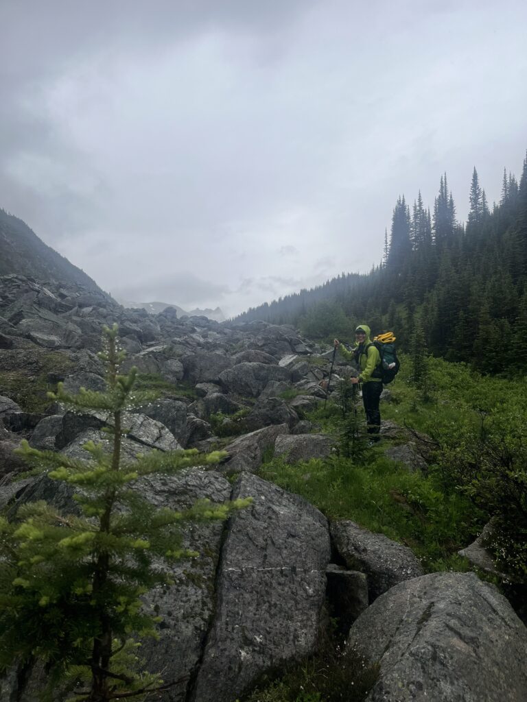
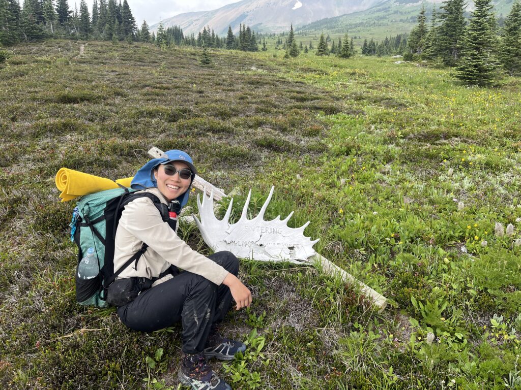
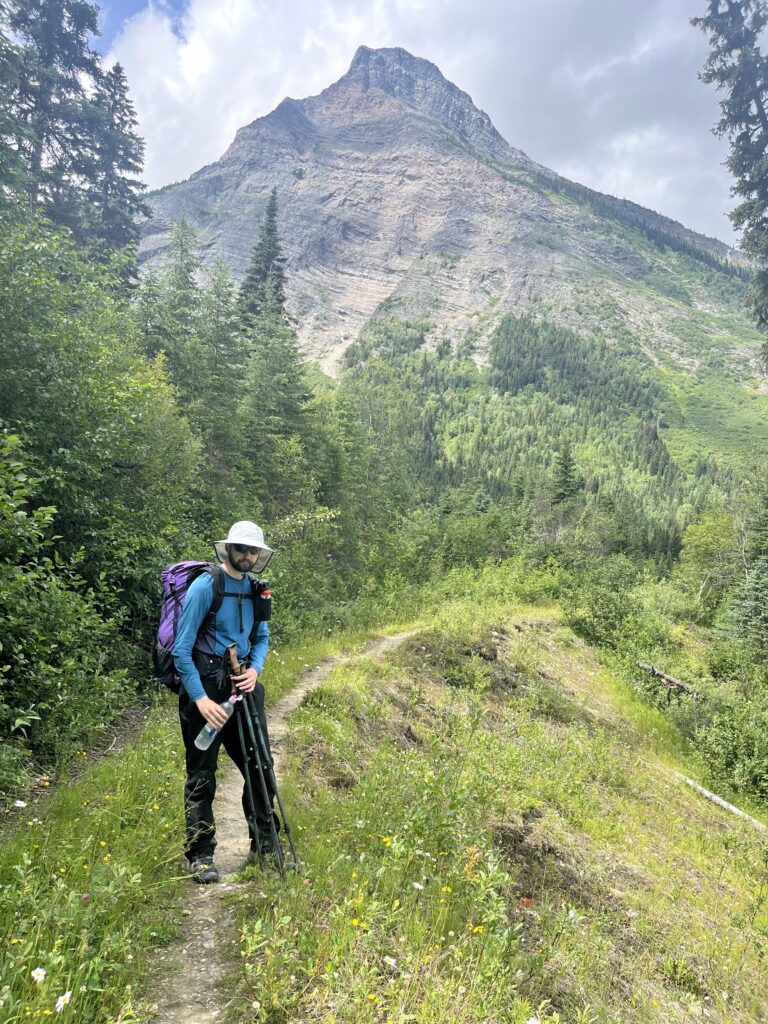
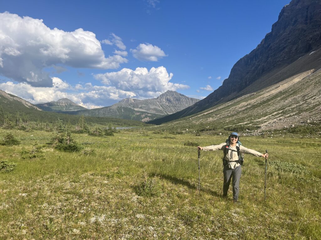
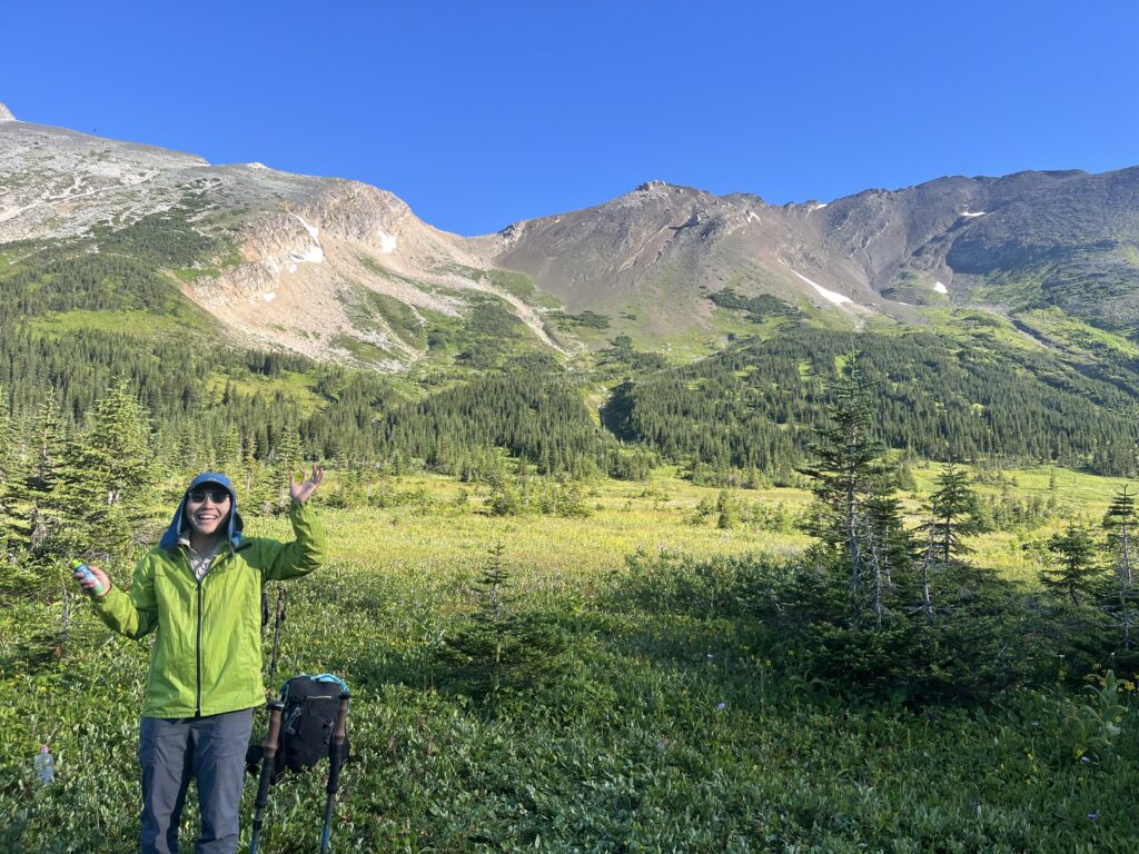
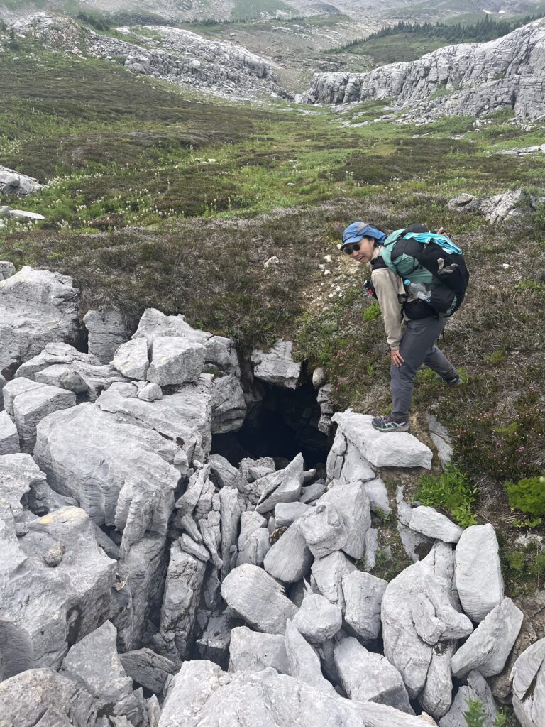
Day 16 – The Start of No Trails
July 27 – 23km – 760m gain – Jarvis Lakes to Narraway River
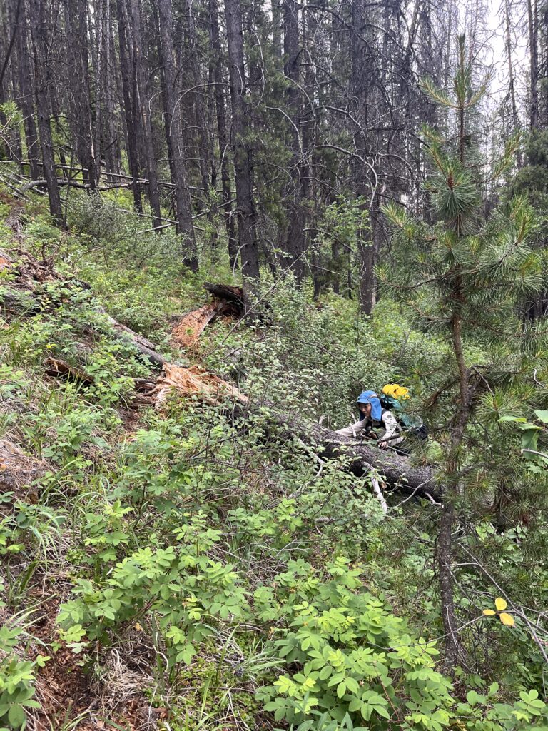
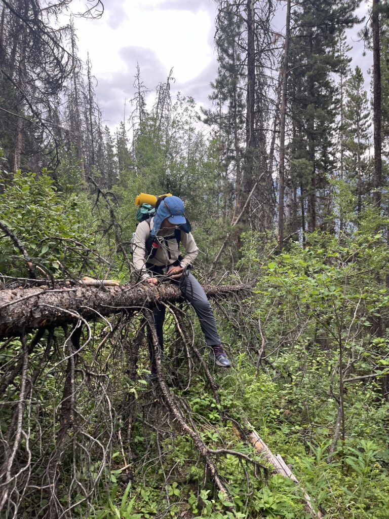
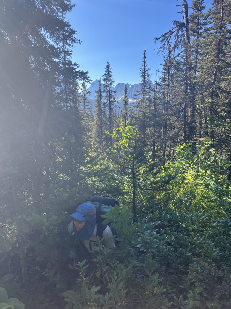
Exiting the cabin was the faintest trail ever that often disappeared. Looking back, this was much harder than many ‘no trail’ sections (such as the alpine). It was awesome to wake up in a dry cabin before we brace our first official GDR day.
Hiking uphill with no trail is a special experience. You really get to be very intimate with lots of plants, as the shrubbery will frequently floss your butt cheeks (luckily we were wearing pants). Unfortunately Bill’s pair developed a hand sized hole right at his crotch which now makes his bits susceptible to both shrubbery and mosquitoes.
Gaining the tree line allowed for spectacular views. Mt Ida and her magnificent glaciers were tantalizing. She was pretty shy and hid her peak in the clouds, though we did get a full frontal yesterday at the cabin.
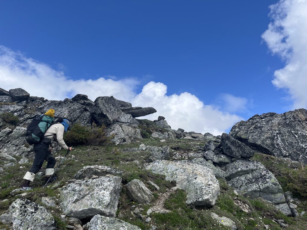
There was about 200m headwall to be gained which was super steep and dense with human height rhododendrons and plenty of deadfall. Hiking uphill in this often required disentangling the branches with all your limbs (more flossing).
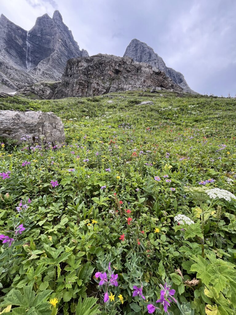
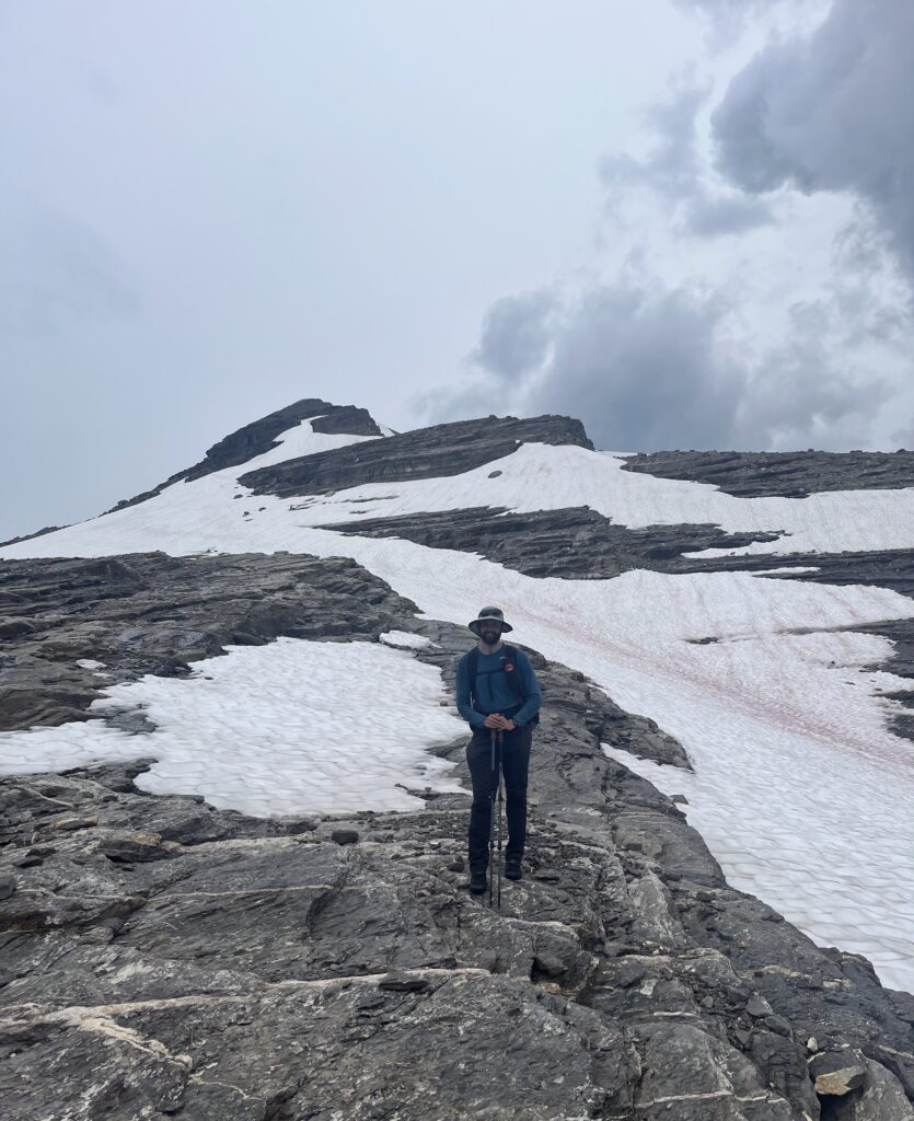
But the alpine walk after was utterly splendid. Glaciers and mountains surround us as we hike through soft moss and alpine flowers. The looming tree line awaited us patiently and we tried to savour the alpine.
The four hours or so descent through the trees to Narraway River luckily had a few small meadows as reprieve. This made today the hardest day we’ve backpacked.
God bless our legs, the sun, and our tent.
Day 17 – Ass Kicker Day
July 28 – 20km – 1010m gain Narraway River to Amisk Lake
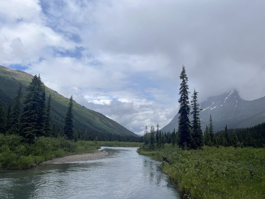
Woke up early, 5:30am, to get an early start. Left camp at 7am and forded the Narraway. Really slow going for the first couple hundred meters of bushwhacking, but it got marginally better.
This was a long and tough bushwhack up to where the meadows started. We were very happy when the travel got easier.
Heard a helicopter a lot this morning. As we neared the saddle to cross into the Watin Mountain area, the heli flew right over us and landed. It was SAR looking for a man , also doing the GDR, who got separated from his partner 2 days ago. Hope they find him.
Had lunch soon after, then kept going. Very difficult and steep rocky traverse, and then a technical rocky descent. Some meadow hopping, then an equally tricky grassy descent. More meadow hopping, some bushwhacking, and some more meadow hopping.
That brought us to Amisk Lake at around 6pm, where we had a dip and set up camp (special dinners!). Not our planned campsite, but we were both exhausted. Very happy to have made it here though, it was a rough day. Ending early puts our zero day at risk – might have to be a nearo instead.
Day 18 – Hardest Backpacking Day in the Books
July 29 – 19km – 1000m gain – Amisk Lake to Desperate Camp
The first two passes of the day were perfect amenable. Beautiful views, easy stuff. Made the day go fast.
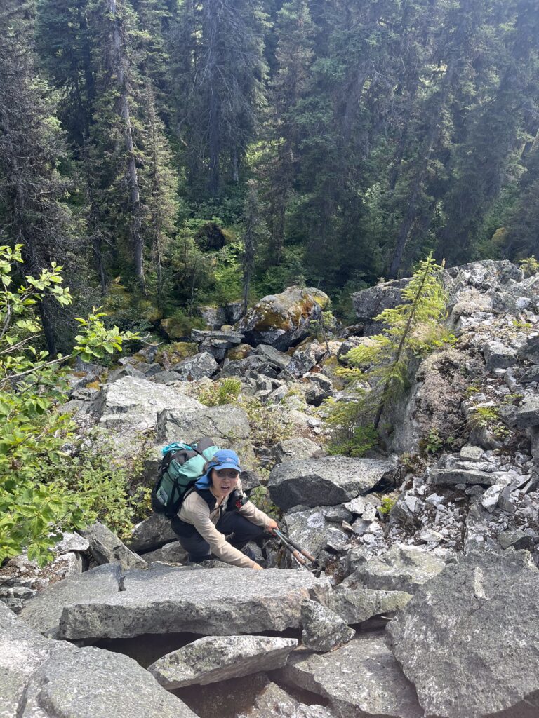
The next bit still makes me shiver. The approach to the last pass was a stretch of about 1.5 km traverse on a steep hill that ranged from merely 30 degrees to upwards of 45, with steeper sections due to the various gullies and avi chutes. Also, the plants were chest to eye level high. Walking on this section turned out to be the hardest hiking Bill and I have ever done. It was so insanely steep, and you can’t see a foot ahead because of the deep bush. There were even dead fall to navigate. And so many gullies in which it got even steeper. It took us 2.5 hours to move less than 2 kilometres. We fell many times. For Viv, this section was the closest she has ever come to tears in the outdoors.
We called camp at the first spot available, happily deleting our zero to trade in no more walking. Our feet are in so much pain we dunked them in the cold river before bed.
It is incredible how much a warm meal and a cozy sleeping bag can change things around. Feeling much better. We laughed about how hard things were and happily went to bed.
Day 19 – Lake Swim Day
July 30 – 19km – 770m gain – Desperate Camp to Gusty Lake
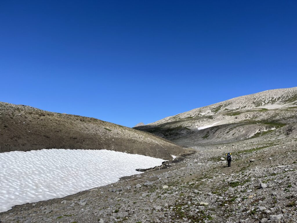
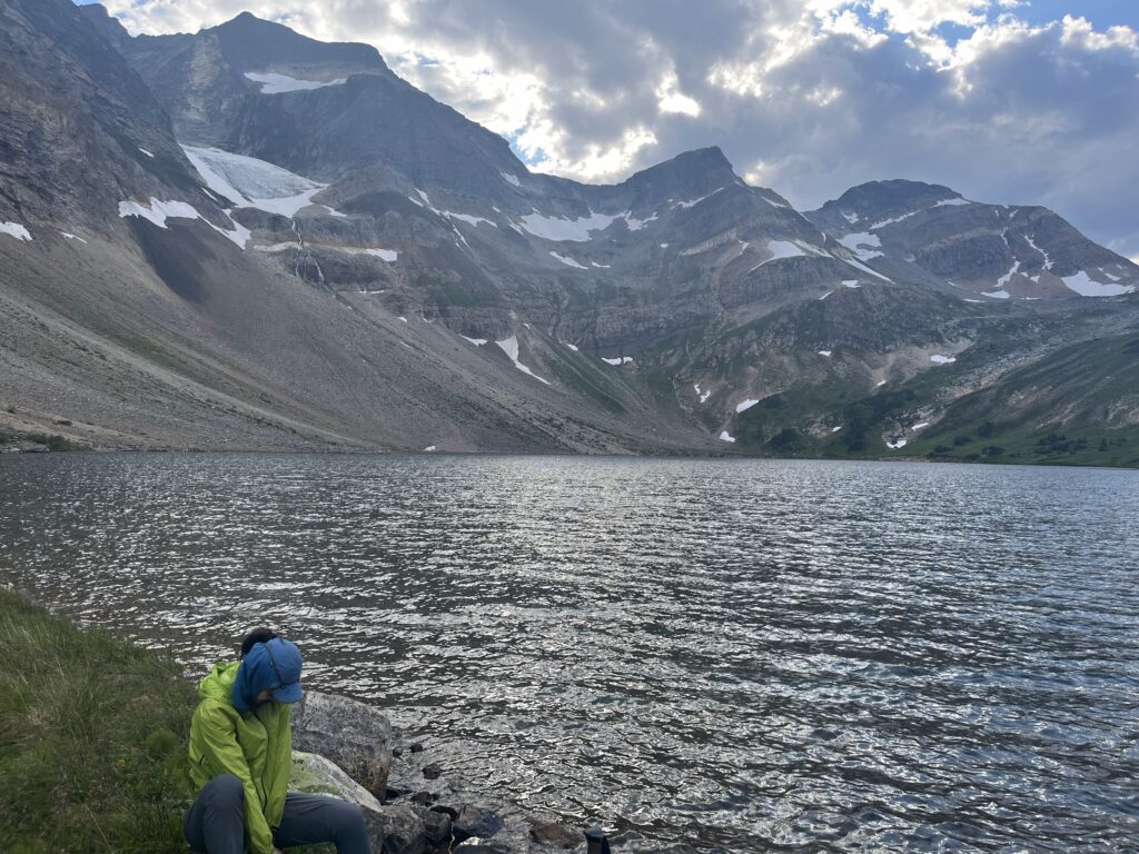
Had a bit of a slow start this morning – still mentally recovering from the sidehilling yesterday. Got going around 8am and had a nice chill ascent up to the pass. Good views, but no hot dog stands, only big rocks. Passed by Relief Pond Camp – good job we didn’t stay there, the pond was very small. We would have survived, but our water source was much better.
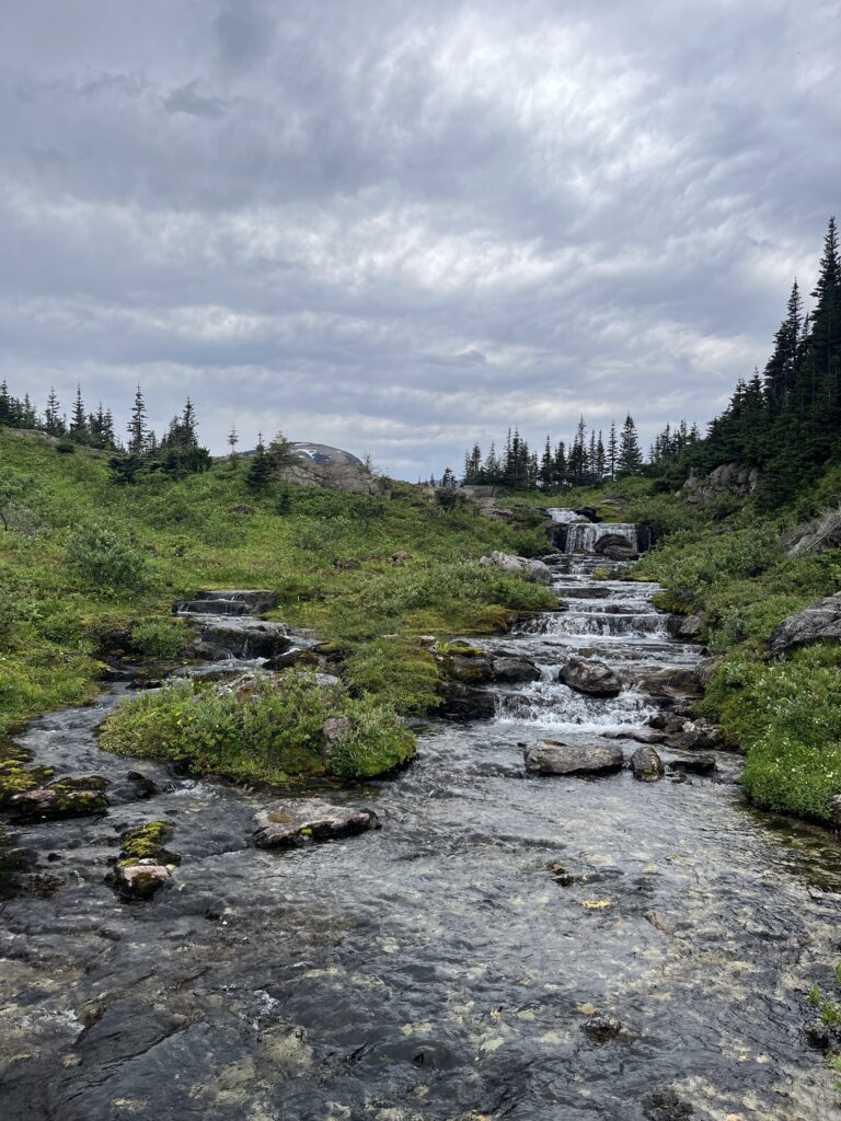
The descent the Warner Lake started with lots of nice meadows connected by game trails. Eventually the meadows stopped and the whacking began. Actually it was not bad for the most part. We had a snack and water refill at a beautiful waterfall!
The last couple kilometers to the camp were very slow, but the lake was gorgeous! Not an amazing campsite, some tarps and garbage left by ATVers. We swam in the lake (well, quick dip in and out) and had lunch.
We considered taking a shortcut up a steep ridge, but decided it was too steep. Also the first couple kilometers of the main route were along the ATV trail, which was super easy going. Then more bushwhacking, a marshy meadow, and two cliff bands to ascend. We climbed straight through the first one, and skired the second. Crazy to think that Gnargaret did this at 78!
Last bit of whacking/ridge walking we were chased by a big thunderstorm, but in the end it passed a bit to the north of us. Scary hearing all the thunder though!
Got to Gusty Lake camp (no wind though) and had another swim. This water wasn’t as frigid, so we actually swam a little bit!
Feeling much more positive today – even though it was a similar distance and time as the last two days, the route today was much easier and we don’t feel nearly as tired.
Day 20 – Nearo!!
July 31 – 12km – 550m gain – Gusty Lake to Tuck Lake
God it feels good to hike almost single digit kilometres! Not that the second ascent was easy – parts were so steep we were tugging at rhodo stems to get up.
We had the luxury of swimming in two lakes and one river. The river was the coldest by far – you felt your bits freeze after merely a few seconds!
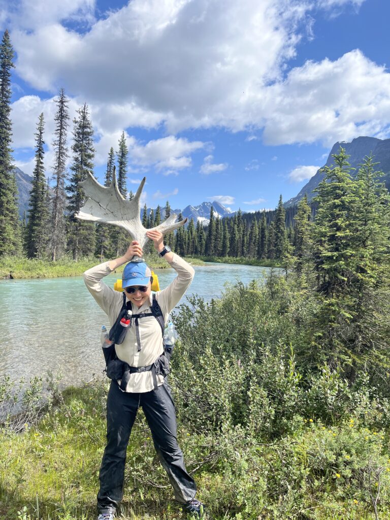
Another treat was a caribou sighting! Usually we (Viv) are so loud so all the animals are far away, so this was awesome! The antlers were enormous, and I think it laughed at how slow we were going in the same bush.
We saw a passenger jet fly by and thought the people in it were probably the closest people to us in that moment.
Getting to lay in our tent at only 4PM was incredible. The booming thunderstorm passed overhead while we watched some TV, and stopped just in time for dinner.
We’re both pretty nervous for tomorrow which includes the longest stretch of bushwhacking- 10 km! But we’re soooo excited and proud to have the end on the horizon!
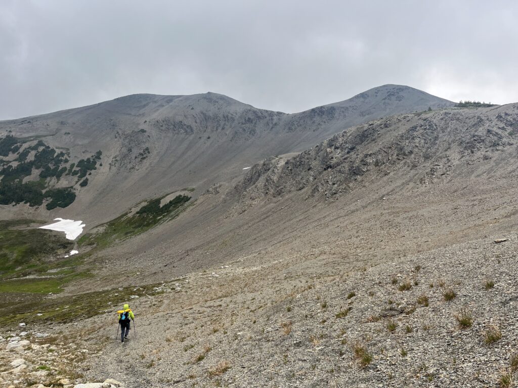
Day 21 – Bushwhack from Valley to Pass
Aug 1 – 18km – 660m gain – Tuck Lake to Second Limestone Lake
Long 10km bushwhack to start the day. It wasn’t raining, but the thunderstorm from yesterday meant all the bushes were wet, and so we were soaked very quickly. Honestly it was kind of nice, and helped keep us cool.
The bushwhacking never got too bad, except for where it was a bit steep. At one point we decided to walk up the Framstead Creek for a bit instead of dealing with the steep bush.
Then we got to a nice meadow! Maybe a kilometre of good walking. We had lunch at the end of the meadow, then back for more bush. Descended to cross the Framstead again, then started climbing.
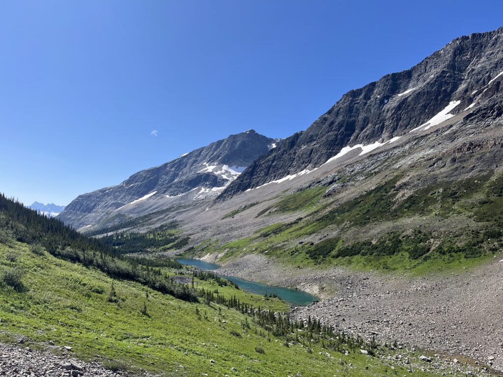
Eventually we got out! Our first full views of Weaver and Limestone peaks were amazing, and it kept getting better the closer we got. The waterfalls and hanging glaciers were magnificent!
We weren’t fully out of the bushes – there were some annoying sections. We used our earlier trick and waded through the creek at times to avoid willows.
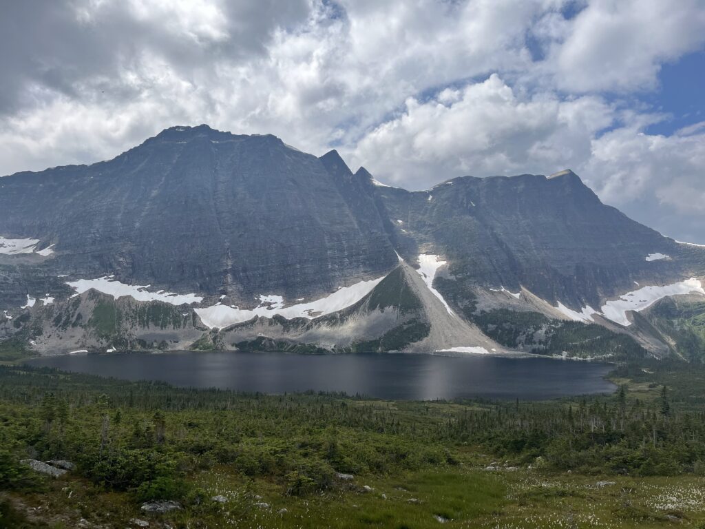
After many ridges, we finally saw the first Limestone Lake! Such a beautiful colour. As we were descending to the lake, we saw a grizzly bear! He was well above us, and travelling in the opposite direction. Maybe 100 metres away. He was really curious, and kept looking back at us, but we just walked on and so did he. It’s likely he’s never seen a human – I too what be curious!
The travel around the first lake wasn’t too bad, but it was a bit bushy and a bit sidehilly. Eventually we just started walking in the lake. It was really shallow near shore, and really not that cold. That sped us up. A short bushwhack brought us to the second lake, where we did our same trick.
We saw a beautiful gravel beach with just enough space for a couple tents. Even though our plan was to get to the third Limestone Lake, it was after 7pm and we couldn’t resist such a nice looking spot. Set up tent, had dinner, quick dip and get dry!
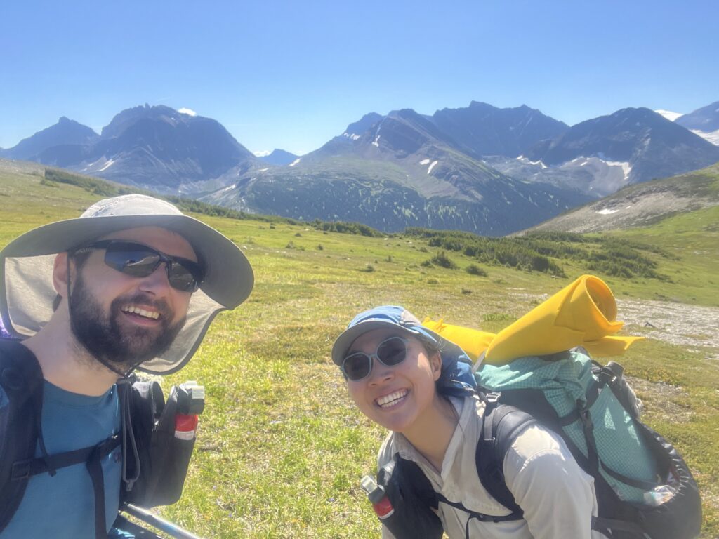
Feeling really good today. The big bushwhack had been worrying us for a while, and we killed it! Only two more days! Tomorrow will be a pretty big day, but hopefully some easy alpine walking at the end. Hoping it doesn’t rain (doubly so for thunderstorms).
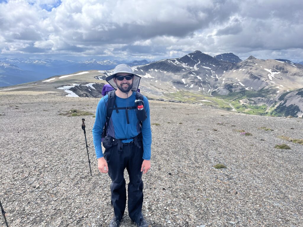
Day 22 (!!!) – High Alpine Goodness
Aug 2 – 27km – 1280m gain – Limestone Lakes to Hugh Lake
Writing this on out last night in the tent feels unreal. The last 9 days in particular on the GDR have really tested us. No trails. No humans.
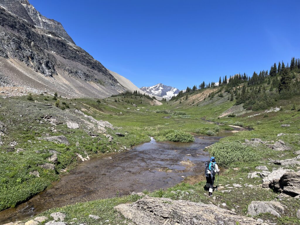
Today’s first 5 clicks were pristine walking along the beautiful Limestone Lakes. We ascended a shoulder to get the view of our last side hilling mission, and the last uphill gain – the Monkman Plateau. Everything was pretty non-dramatic (except the scenery) and the sidehilling did not bring up too much trauma from Day 18.
When we were about to crest Monkman Saddle, a young caribou passed us and ran up the saddle (much faster than we would). Like the grizzly yesterday, it was really curious so I don’t think they see humans much.
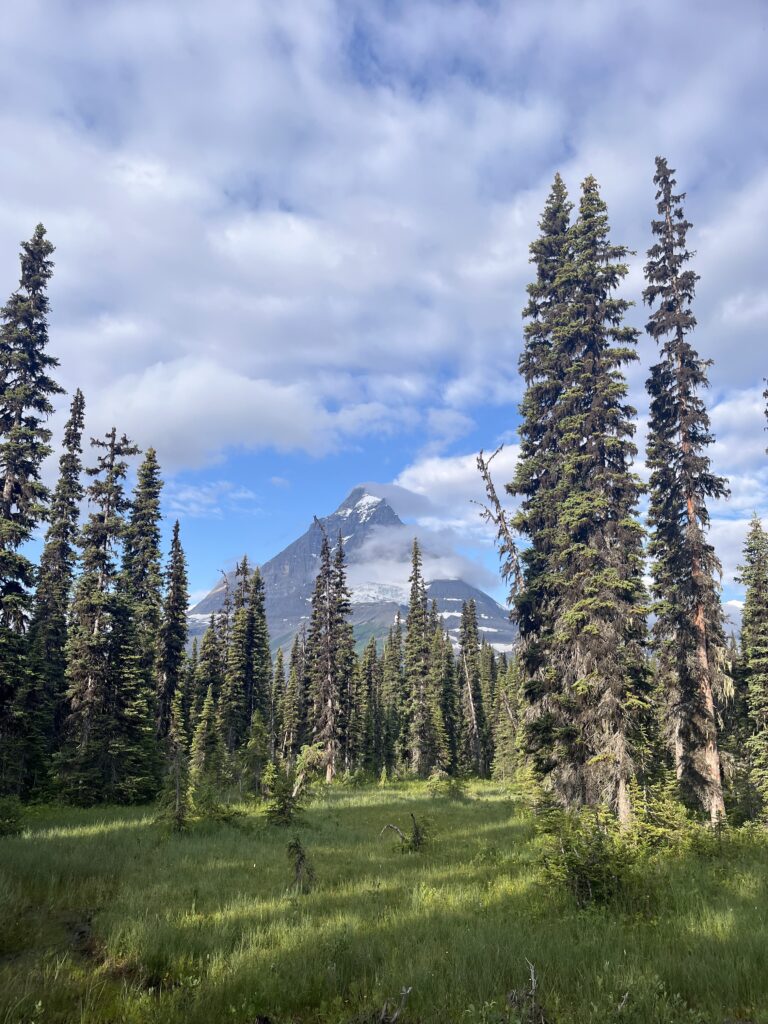
Monkman pass was absolutely gorgeous. We were surrounded by peaks and glaciers. This is the stuff that keeps us going.
Incredibly the thuderstorm rain only started after we got in the tent. One more sleep!
Day 23 – Last Day!
Aug 3 – 35km – 780m gain – Hugh Lake to Kinuseo Falls
Our last day! Wow! We woke up early (5:30am) and felt super energized. Real food! Shower! Hanging out with friends! All just 35kms away.
As we were eating breakfast on the shore of Lake Hugh, we suddenly saw a huge male caribou about 20m from us. His antlers were absolutely massive. It would have been a great photo, but we were focused on making noise to get him to go away. He didn’t seem that scared of us, but did climb up away from the lake. One of our coolest wildlife sightings!
We had a bit of route finding out of Hugh Lake. We picked up some cairns on the way to some viewpoints – as we went further there were more and more cairns. The views were pretty spectacular – behind to the Monkman plateau, and ahead down to Monkman Lake! At some point we picked up trail! It came in and out at first, but soon we were on decent trail (maintained! cut deadfall!). It was steep and muddy at times, but overall we were making pretty good time.
The campsite at Monkman Lake was really nice – picnic tables and tent pads and bear lockers. No one was camping there, and we just ripped past. The trail from here was good, but often a bit bushy. Not bad enough to stop us from changing into shorts – first time in shorts since 23 days ago! We met our first people (since meeting the SAR crew 6 days ago).
The trail started to get a bit tedious. It’s kind of boring just hiking on trail! No navigating necessary, no bushwhacking or cliff bands, just go forward. It was also quite a long day for us, and we were eagerly counting down the kilometres. The suspension bridge was pretty cool though!
Finally we got to the front-country site! There was a log book near the trailhead – we saw Sterling’s entry plus another hiker who did the GDR! I wonder how popular it will get in the years to come. We left a quick note. We’re done!
We wandered around the site for a bit trying to find Patrick and Marina – suddenly a truck pulled up behind us and honked – they found us! It was so good to hang out with them after so long. And meet Aaliyah (Viv’s favourite baby)! They brought all sorts of food – some salad, Northern Lights wine, sausages for the BBQ. We ate at least 4 sausages each.
After a bit we drove to the actual falls – they’re huge! Super pretty, way better than I expected. Then we drove back to Chetwynd – about 2 hours away. Shower! Real bed!
After an epic trip, we were ready to sleep in.
Wow 🤩 what a spectacular achievement. An adventure of another level.
I can understand you wanting to go again. This gets in your bones at it calls to you. I can hardly wait to go on my walk again.
Well done guys. 💯💯💯🎉👏🏽👏🏽👏🏽
Great trip writeup!! Doing the GDR after sections F and G is a special kind of tough! I can relate, as I hiked the south half of the GDR last summer. I laughed reading about your Ass Kicker day ending at Amisk Lake; I did the same stretch from the Narraway River to Amisk Lake and that was my hardest day too.
Nicely done. You guys crushed it. So cool you saw so much wildlife.
Thanks for your entertaining report and great photos. The GDR is an amazing experience to share with friends. I wouldn’t want to do it solo!
We were fortunate to have relatively good weather.
Congratulations
Gnargaret